
GeoSphere Austria · sources
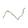
Elevation profile
Snow depth
Model · 1 kmLoading snow model …
- Distance
- 13.5 km
- Ascent
- 1,905 m
- Descent from source
- 1,905 m
Ski tour · Kanton Wallis. The published line is 13.5 km long.
Map layers
Take the route with you
Download GPX ↓Original route geometry with estimated elevations from our terrain model. No account or app required.
ODbL 1.0 + CC BY-SA 3.0 FR · Licence. Source credits are included in the file.
- Highest point
- ≈ 3,500 m
Source directions
Da b.s.pierre prendere la strada forestale che porta allo chalet d'Azerin,da qui portarsi nella comba di challand, passando per Challand d'en Haut m.2224.Risalire l'ampio vallone passando a destra del Six Rouge,attraversare il piano situato a q. 2800 per portarsi sotto il colouir sud ovest,risalirlo fino a 50 m dalla vetta,poi per la cresta guadagnare la vetta.
Source safety information
41 gradi per 250m,con passaggio a 45 gradi
Tranne il colouir il resto della gita è esposto a Nord OVEST- OVEST
Accesso :
Gallarate, aosta ,traforo G.s. BERNARDO ,Bour Saint Pierre
Source equipment information
Piccozza Ramponi
Source directions
[img=193034 right]Du Ritord au col du Moine[/img]
##Montée
Prendre un petit chemin forestier qui traverse La forêt des Rames. Traverser le torrent de la Croix, passer par le chalet Azerin et poursuivre qu'à Challand d'en Haut (2224 m). Remonter la combe de Challand et continuer dans des pentes plus raides à droite des Six Rouges. Possibilité aussi de contourner les Six Rouges par la combe (moins raide) en passant sous Beaufort.
Rejoindre ainsi un plateau à 2800 m. Traverser le plateau et monter à gauche dans des pentes assez larges qui se redressent et qui permettent de rejoindre le pied du couloir. Remonter le couloir jusqu'à son origine (dépôt des skis) et gagner le sommet par l'arête.
##Descente
Par le même itinéraire.
Source safety information
* Ça monte bien, pas trop de plat.
* 41° sur 250 m avec un passage à 45°.
* Labande annonce D+ pour ce couloir. il n'en est rien. D-/D maxi.
* Si on part du sommet à ski: D+ mais cela nécessite un fort enneigement.
- Le couloir est orienté SW,la descente est orientée W à partir des Six Rouges
Source equipment information
* Crampons, piolet et éventuellement corde.
The map shows the published line. Provider ascent and descent retain their original meaning; estimates along the line are marked ≈. An additional return route is not automatically included in the line. Elevation profile estimated from Copernicus DEM. Provider statistics may differ.
Weather · next 48 hours
Loading weather …
BULLETIN
Avalanche bulletins along this route
Bulletin regions along this line: Val d'Entremont - Val Ferret
Regional avalanche bulletins do not assess an individual route. Check validity, elevation and aspect.
NATUR · NATURE
Protected areas along the route
No protected area was found along this line in the available dataset. Follow local notices.
Open on your iPhone · QR
Source & data
Camptocamp · Camptocamp-Association, Céline Stern-Kiener, Christian, alexduchablais, Evi, Alexandre Zugger, rabot, botopo · https://www.camptocamp.org/routes/45211 · Coordinates reprojected; DEM elevation estimates · ODbL 1.0 + CC BY-SA 3.0 FR
Camptocamp · 2018-11-19T17:11:44.124060+00:00
Produced using Copernicus WorldDEM-30 © DLR e.V. 2010-2014 and © Airbus Defence and Space GmbH 2014-2018 provided under COPERNICUS by the European Union and ESA; all rights reserved.
Tour-ID: c2c:route/45211 · Revision: 05a5a85dad85