
GeoSphere Austria · sources
Elevation profile
Snow depth
Model · 1 kmLoading snow model …
- Distance
- 7.2 km
- Ascent
- 733 m
- Descent along this line
- ≈ 745 m
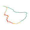
Ski tour · Département Haute-Savoie. The published line is 7.2 km long.
Map layers
Take the route with you
Download GPX ↓Original route geometry with estimated elevations from our terrain model. No account or app required.
ODbL 1.0 + CC BY-SA 3.0 FR · Licence. Source credits are included in the file.
- Highest point
- ≈ 1,968 m
Source summary
In order to discourage people skinning up the Pierre Ric piste, the local commune has initiated this sane alternative to reach the Lognan ski station, in a similar way to the one up to the Prarion at Les Houches. Justifiably popular with uphill enthusiasts, it provides a bad weather option, or a short, training route with easy access and a fast, safe descent.
Source directions
##Approach # 5mins
2 possibilities:
1. From the main Grand Montets car park: Follow the Pierre Ric piste to the bridge over the road. Turn off to the right, yellow banner marking the start of the track, to quickly join the ski du fond track. Turn right and follow this track, (and little yellow signs,) until the ski du fond track bends right to go down a steepish hill. At this point, go left up a little incline to reach the top of the Chosalets ski drag.
2. Park as for the Chosalets ski drag and skin up the piste to the top of the longer lift.
##Route # 1-2hrs
From the top of the ski lift, a few metres of descent brings you to the start of the path in the forest, (the same as the summer path.) The path zigs zags up through the forest, fairly steeply at first, but soon eases off. Occasional little yellow signs. Some of the turns may be awkward if icy. Eventually, you arrive just below the Joran restaurant, where a path on the right leads up to this. Continuing straight on brings you to a wider, pisted track which traverses up to the Lognan lifts area.
##Descent
Down the Pierre Ric piste
Alternatively, if conditions allow, one of several options back down through the forest below the Joran.
Source summary
Afin de décourager les randonneurs de monter par la piste de Pierre à Ric, la commune a initié cette alternative pour rejoindre la station de ski de Lognan, à l'instar de celle qui monte au Prarion des Houches. Justement populaire auprès des amateurs de montée, elle offre une option par mauvais temps, ou un court parcours d'entraînement avec un accès facile et une descente rapide et sûre.
Source directions
##Approche # 5min
2 possibilités :
- Depuis le parking principal des Grands Montets : Suivre la piste Pierre Ric jusqu'au pont sur la route. Tourner à droite, banderole jaune marquant le début de la piste, pour rejoindre rapidement la piste de ski du fond. Prendre à droite et suivre cette piste (et les petits panneaux jaunes) jusqu'à ce que la piste de ski de fond tourne à droite. À cet endroit, rester à gauche et monter une petite pente pour atteindre le sommet de la piste de ski des Chosalets.
- Depuis la piste de ski des Chosalets et remonter la piste jusqu'au sommet du plus long téléski.
##Montée # 1 à 2h
Du haut du téléski, descendre quelques mètres pour trouver le début du sentier dans la forêt, (le même que celui de l'été). Le sentier zigzague à travers la forêt, assez raide au début, mais s'atténue rapidement. Balisage régulier, petits panneaux jaunes. Nombreuses épingles. Dès la sortie de la forêt arriver juste en dessous du restaurant de Plan Joran. Continuer par une "piste de service" plus large qui mène jusqu'à Lognan.
##Descente
Descendre par la piste Pierre à Ric
Ou, si les conditions le permettent, l'une des nombreuses options de descente par la forêt en dessous de Plan Joran.
Source safety information
- Le chemin peut-être gelé et les virages seront plus difficiles à négocier.
- Ce chemin n'est à suivre que pour la montée.
The map shows the published line. Provider ascent and descent retain their original meaning; estimates along the line are marked ≈. An additional return route is not automatically included in the line. Elevation profile estimated from Copernicus DEM. Provider statistics may differ.
Weather · next 48 hours
Loading weather …
BULLETIN
Avalanche bulletins along this route
No EUREGIO bulletin region is assigned to this line.
Check the official report for current danger and validity. Avalanche warning services
Regional avalanche bulletins do not assess an individual route. Check validity, elevation and aspect.
NATUR · NATURE
Protected areas along the route
Massif Du Mont Blanc (3 Décisions)
Site classé selon la loi de 1930
Kartendarstellung vereinfacht; maßgeblich ist die verlinkte Originalquelle.
Open on your iPhone · QR
Source & data
Camptocamp · Christian, Mathieu des Noes, Gus Morton, Borut, CaBot · https://www.camptocamp.org/routes/593635 · Coordinates reprojected; DEM elevation estimates · ODbL 1.0 + CC BY-SA 3.0 FR
Camptocamp · 2021-02-19T10:17:45.172152+00:00
Produced using Copernicus WorldDEM-30 © DLR e.V. 2010-2014 and © Airbus Defence and Space GmbH 2014-2018 provided under COPERNICUS by the European Union and ESA; all rights reserved.
Tour-ID: c2c:route/593635 · Revision: 8939c219a7c1