Quellenhinweise / Source notes / Note della fonte
Die Quelle übernimmt keine Gewähr für Vollständigkeit oder Richtigkeit. / The source provides no guarantee of completeness or correctness. / La fonte non garantisce completezza o correttezza.
 HanglageSki touring & trail running
Loading snow model …
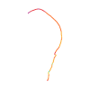
Original route geometry with estimated elevations from our terrain model. No account or app required.
CC BY-ND 4.0 · Licence. Source credits are included in the file.
These notices come from the stored source snapshot. They do not establish a current closure. Check the source website for current information.
Die Quelle übernimmt keine Gewähr für Vollständigkeit oder Richtigkeit. / The source provides no guarantee of completeness or correctness. / La fonte non garantisce completezza o correttezza.
Elevation profile estimated by Hanglage from Copernicus DEM. Original ÖAV, DAV and AVS data remain unchanged.
Loading weather …
BULLETIN
Bulletin regions along this line: Samnaun Mountains, Samnaun
Check the official report for current danger and validity. Avalanche warning services
Regional avalanche bulletins do not assess an individual route. Check validity, elevation and aspect.
NATUR · NATURE
© ÖAV, DAV, AVS – Ski Touring Routes for Austria, Germany and South Tyrol, CC BY-ND 4.0 · CC BY-ND 4.0
ÖAV · DAV · AVS · 2026-11-01T09:53:15Z
Produced using Copernicus WorldDEM-30 © DLR e.V. 2010-2014 and © Airbus Defence and Space GmbH 2014-2018 provided under COPERNICUS by the European Union and ESA; all rights reserved.
Tour-ID: alpine-club:austria/6916 · Revision: 992efeac753a