
GeoSphere Austria · sources
Ski tours · Kanton Bern
Mieschflue · da Blankenburg per Vehsattel e lo Houweggli-Sattel
Elevation profile
Snow depth
Model · 1 kmLoading snow model …
- Distance
- 12.2 km
- Ascent
- 1,200 m
- Descent from source
- 1,200 m
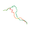
Ski tour · Kanton Bern. The published line is 12.2 km long.
Map layers
Take the route with you
Download GPX ↓Original route geometry with estimated elevations from our terrain model. No account or app required.
ODbL 1.0 + CC BY-SA 3.0 FR · Licence. Source credits are included in the file.
- Highest point
- ≈ 2,106 m
Source directions
Si posteggia vicino l’Hotel Husy. Si percorre la strada principale del paese verso monte, si attraversa il torrente e passando tra le ultime case si segue la strada innevata che si inoltra in una valletta in direzione NE. Superato su di un ponte nuovamente il torrente si imbocca subito dopo un sentiero nel bosco verso sinistra che incrocia nuovamente la strada poco più sopra in corrispondenza di un casolare. Risalire un prato ripido a monte di questo in direzione E fino a ritrovare la strada ed un cartello segnaletico estivo con indicazione fra cui Fromatt e Vehsattel. Prendere quest’ultima direzione ora lungo la stradina, poco dopo un'altra baita isolata si prosegue verso S sempre sul tracciato stradale quasi piano. Giunti a Vehsattel m 1712, in un ambiente incantevole, si continua verso E attraversando i pendii basali N del Gandhore, bella gita scialpinistica piuttosto impegnativa. Un paio di ripidi gradini del terreno permettono di raggiungere il pianetto a 1920 m circa sotto il ripido versante W del Brunnihore. Ancora verso E sino al colle Ussers Houweggli da cui una breve crestina N ci porta in vetta.
DISCESA: per il percorso di salita scegliendo con brevi spostamenti laterali i pendii più ripidi e remunerativi.
Source safety information
Itinerario non difficile e piuttosto sicuro. Sciisticamente non continuo causa alcuni pianetti che costringono a spingere anche in discesa.
The map shows the published line. Provider ascent and descent retain their original meaning; estimates along the line are marked ≈. An additional return route is not automatically included in the line. Elevation profile estimated from Copernicus DEM. Provider statistics may differ.
Weather · next 48 hours
Loading weather …
BULLETIN
Avalanche bulletins along this route
Bulletin regions along this line: Lenk, Obersimmental
Regional avalanche bulletins do not assess an individual route. Check validity, elevation and aspect.
NATUR · NATURE
Protected areas along the route
Grosswaldreservat Diemtigtal
Waldreservate
Kartendarstellung vereinfacht; maßgeblich ist die verlinkte Originalquelle.
Open on your iPhone · QR
Source & data
Camptocamp · BertrandSemelet, Edoardo Satiro, botopo · https://www.camptocamp.org/routes/325718 · Coordinates reprojected; DEM elevation estimates · ODbL 1.0 + CC BY-SA 3.0 FR
Camptocamp · 2019-02-19T07:39:43.415990+00:00
Produced using Copernicus WorldDEM-30 © DLR e.V. 2010-2014 and © Airbus Defence and Space GmbH 2014-2018 provided under COPERNICUS by the European Union and ESA; all rights reserved.
Tour-ID: c2c:route/325718 · Revision: b6eaa3c521e5