
GeoSphere Austria · sources
Elevation profile
Snow depth
Model · 1 kmLoading snow model …
- Distance
- 18.6 km
- Ascent
- 2,220 m
- Descent from source
- 2,220 m
Ski tour · Kanton Wallis. The published line is 18.6 km long.
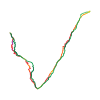
Map layers
Take the route with you
Download GPX ↓Original route geometry with estimated elevations from our terrain model. No account or app required.
ODbL 1.0 + CC BY-SA 3.0 FR · Licence. Source credits are included in the file.
- Highest point
- ≈ 3,712 m
Source summary
High mountain tour to a superb summit which can be done in a very long day or by sleeping at the bivouac hut.
Source directions
## Ascent # to the Cesare Fiorio Bivouac:
*Route with grid references from the Swiss map:*
[img=165212 right]Mont Dolent[/img]
After La Fouly, park the car 100m before Le Clou (573470-86150). Go down to the Dranse de Ferret and cross it bridge. Climb back up to the SW until 1798m (573200-85640). Go S, then slightly to the E to reach la Léchere (573340-85420).
Climb SW and then go along the Crette de la Gouille to the S, until the NE foot of the Crette de la Perche (8572515-84495). Continue diagonally slightly rightwards and go into the Combe des Fonds. Follow this to the Petit Col Ferret (571180-82875).
*At the end of the season or when there is a very low avalanche risk, it is possible to go up the Combe des Fonds from la Fouly, (same start as for the Grande Lui).*
Cross the col to the right without losing any height to reach the S ridge of the Pointe de Allobrogia (570935-82815). Go NW pour to reach the Fiorio hut (570595-83415).
##Ascent # From the bivouac to the summit of Mont Dolent:
Go W, then slightly N to reach the Pré de Barre glacier (569955-83780) close to a rocky spur (2900m). The traverse on steep slopes towards the glacier, ski crampons may be necessary.
Going N pass to the E of Points 3188m et 3336m (569975-84530). Go up the glacier to the bergshrund. Go up the final snow slopes until the foot of the rocks on the SE ridge, ski depot. Keep to the W side of the SE ridge then go up a gully to rejoin the ridge just before the summit.
##Descent
If conditions allow it is possible to ski from the summit, (see remarks). Make an exposed traverse under the ridge to reach a large gully. Descend the first part and make a little traverse to the left to reach the ascent gully.
For the remainder the descent route is basically the same as for the ascent, choosing the best slopes for skiing.
Source safety information
Starting the descent from the summit can be awkward depending on the conditions (45° (S5) very exposed) The grading at this point is D+
The S4 grading assumes starting from the ski depot.
Orientation : Up to the Petit Col Ferret NE, then SE.
Source equipment information
Crevasse rescue gear
Source directions
[img=165212 right/]
## Salita
Da La Fouly (1598 m) proseguire oltre il paese lungo la strada di fondovalle per circa 1 km sino alla località Le Clou, imboccare poi una stradina che scende alla propria destra (cartelli indicatori per il Pt. Col Ferret) al torrente. Attraversare su di un ponticello la Drance de Ferret e seguendo la direttrice della pista da fondo proseguire fiancheggiando il torrente per circa 1 km. Laddove il bosco che fiancheggia la pista si dirada abbandonare la pista e deviando alla propria destra (W) risalire delle belle radure inalzandosi rapidamente di quota. Senza percorso obbligato puntare verso SW per raggiungere a circa 2000 m di quota un caratteristico avvallamento denominato Combe de Fonds. Seguire questa valletta su pendenze moderate e raggiungere senza difficoltà il Pt. Col Ferret (2490 m), vallico che adduce alla Val Ferret ‘Italiana’.
Vallicare il colle, scavalcando la cresta spartiacque che scende dalla Pointe de Allobrogia ed iniziare un traverso verso N su ripidi pendii (attenzione con neve instabile). Dopo questo traverso di circa un centinaio di metri si risalgono una serie di vallette e senza percorso obbligato si perviene prima al ‘vecchio’ Bivacco Fiorio e poi al ‘nuovo’ e più grande Fiorio (2729 m).
Proseguendo su terreno aperto verso NW puntare al ramo orientale del Glacier di Pre de Bard raggiungendolo ad una quota di circa 3100 m (in questo parte si superano un paio di tratti ripidi). Una volta sul ghiacciaio lasciarsi alla propria sinistra la Q.ta 3188 e puntare in direzione della vetta del Mont Dolent, ora ben visibile. Bordeggiare la base del versante SW del Monts Grépilon, superare a circa 3380 m di quota una ripida gobba del ghiacciaio e raggiungere infine i plateau sommitali. Con percorso evidente e privo di difficoltà portarsi alla selletta alla base della cresta SE, a circa 3600 m di quota, del Mont Dolent dove si generalmente è ubicato il deposito sci. Proseguire a piedi e dopo aver costeggiato le rocce basali della cresta innalzarsi direttamente lungo il nevoso fianco meridionale della montagna (40°) sino a raggiungere la cresta sommitale. Da qui in breve, per bella e panoramica cresta, si perviene al punto sommitale.
## Discesa
Per lo stesso itinerario.
Source safety information
* Gita dal grande dislivello e che nella seconda parte percorre pendii che seppur mai estremi sono piuttosto continui. La parte alpinistica finale non presenta particolari difficoltà, almeno in normali condizioni.
* La discesa dalla vetta è possibile (circa 150 m a 45° expo, S5).
* La prima parte della gita sino al Pt. Col Ferret è esposta a NE, oltre l'itinerario è rivolto ai quadranti meridionali.
Source equipment information
Piccozza e ramponi necessari per il raggiungimento della vetta. Percorrendo un ghiacciaio è raccomandabile la corda nel sacco.
Source summary
Course de haute montagne sur un superbe sommet qui peut se faire en un jour (partir tôt, le dénivelé est important) ou en dormant aux bivouacs (rustiques).
Source directions
[img=165212 right]Le mont Dolent itinéraire depuis le petit col Ferret[/img]
##Montée
Rejoindre le Petit Col Ferret, puis de là, prendre direction W pt 2513 (passage expo si trace gelée). Continuer direction NNW pour passer au bivouac Fiorio. Continuer direction N, par le bas du glacier du petit Grépillon jusqu'au pt 570240/84375. Puis, glacier Pré de Bar, passer à l'E des points 3188 et 3336.
S'élever sur le glacier plein N jusqu'à la rimaye. Monter par la croupe (court déchaussage) jusqu'au pied de la partie rocheuse de l'arête SE, pose des skis au col 3627 m. Atteindre le sommet à pied en contournant par l'W l'arête SE, pour remonter un couloir qui rejoint l'arête à peu de distance du sommet (attention à la corniche).
##Descente
Si les conditions le permettent, chausser les skis au sommet. Par une traversée exposée sous l'arête de montée, arriver à un large couloir, descendre la première partie. Une petite traversée sur la gauche ramène dans le couloir de montée.
Pour la suite, l'itinéraire est sensiblement le même qu'à la montée, avec la possibilité de choisir les pentes les plus favorables au ski.
Source safety information
* Le départ de la descente à ski depuis le sommet peut être délicat suivant les conditions (45° (S5) très exposé), la cotation est alors D+ S5 / 4.2 E4.
* La cotation indiquée ici est pour un départ depuis le dépôt des skis.
* Orientation : début de la montée NE, puis SE.
Source directions
[img=165212 right/]
Se incluyen las cordenadas del mapa (rejilla suiza Swisstopo).
Después de La Fouly, 100m antes del lugar llamado Le Clou (573470-86150), descender hacia el río Dranse de Ferret. Atravesarlo, (puente) y remontar en dirección SW hasta 1798 m de altitud (573200-85640). S, ligeramente E, llegar a La Léchere (573340-85420). Subir SW regularmente y a lo largo de la vertiente S de la Crette de la Gouille, hasta el pie NE de la Crette de la Perche (8572515-84495), luego avanzar ligeramente a la derecha para entrar en la Combe des Fonds que seguimos hasta el Petit Col de Ferret (571180-82875).
En fin de temporada, o con un débil peligro de avalancha, se puede remontar desde el inicio la Combe des Fonds desde la Fouly (inicio similar al de la Grande Lui).
Atravesar el collado a la derecha sin perder altitud para alcanzar la arista S de la Punta de Allobrogia (570935-82815). Hacia el NW llegar al refugio Fiorio (570595-83415). W, ligeramente N, llegar al Glacier de Pré de Barre (569955-83780) pasando cerca del espolón rocoso (2900m de altitud). La travesía hacia el glaciar pasa por pendientes fuertes, las cuchillas pueden ser necesarias.
En dirección N, pasar al E de los puntos 3188 et 3336m (569975-84530). Elevarse por el glaciar hasta la rimaya. Subir por el lomo glaciar hasta el collado en la arista SE donde se dejan los skis. Alcanzar la cima a pie, sea remontando directamente la arista SE por el empinado corredor (45°, 150 m) y luego seguir por el filo de la arista casi horizontal, o bien rodeando la arista SE por la izquierda remontando las pendientes bajo la arista somital (40°).
Descenso: si las condiciones lo permiten, calzarse los skis en la cima. mediante una travesía expuesta bajo la arista somital se llega a un ancho corredor del que descendemos la parte superior. Un pequeña travesía a la izquierda, nos lleva hasta el collado de subida.
El resto del descenso es similar al de subida, con la posibilidad de escoger las pendientes más favorables al esquí.
Source safety information
* Ascensión de alta montaña con recorrido glaciar y un desnivel muy importante si se hace en el día.
* El inicio del descenso a esquí desde la cima puede ser delicado según las condiciones (45° (S5), muy expuesto), la cotación es entonces D.
* Cima soberbia que puede hacerse en un día (salir pronto) o dormir en los vivacs (rústicos).
* Hasta el Petit Col Ferret NE, luego SE
The map shows the published line. Provider ascent and descent retain their original meaning; estimates along the line are marked ≈. An additional return route is not automatically included in the line. Elevation profile estimated from Copernicus DEM. Provider statistics may differ.
Weather · next 48 hours
Loading weather …
BULLETIN
Avalanche bulletins along this route
Bulletin regions along this line: Val d'Entremont - Val Ferret
Regional avalanche bulletins do not assess an individual route. Check validity, elevation and aspect.
NATUR · NATURE
Protected areas along the route
Val Ferret / Combe de l'A
Bundesinventar der eidgenössischen Jagdbanngebiete
Kartendarstellung vereinfacht; maßgeblich ist die verlinkte Originalquelle.
Open on your iPhone · QR
Source & data
Camptocamp · Camptocamp-Association, Céline Stern-Kiener, Christian, José Picheral, XavAlex, SimonP, Jean-Louis Pitteloud, Gus Morton, Thomas Charbonneau, Philippe Queinnec, Compte Modération Topoguide, L. Besson, Sophie Ferlin, J-Marc, clash_ch, Julien Vogler, rabot, botopo, CaBot, 1199635, pioletdo · https://www.camptocamp.org/routes/45882 · Coordinates reprojected; DEM elevation estimates · ODbL 1.0 + CC BY-SA 3.0 FR
Camptocamp · 2025-05-12T09:30:32.335399+00:00
Produced using Copernicus WorldDEM-30 © DLR e.V. 2010-2014 and © Airbus Defence and Space GmbH 2014-2018 provided under COPERNICUS by the European Union and ESA; all rights reserved.
Tour-ID: c2c:route/45882 · Revision: 339ca4ab6e01