
GeoSphere Austria · sources
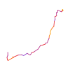
Elevation profile
Snow depth
Model · 1 kmLoading snow model …
- Distance
- 2.3 km
- Ascent
- 780 m
- Descent along this line
- ≈ 2 m
Ski tour · Département Isère. The published line is 2.3 km long.
Map layers
Take the route with you
Download GPX ↓Original route geometry with estimated elevations from our terrain model. No account or app required.
ODbL 1.0 + CC BY-SA 3.0 FR · Licence. Source credits are included in the file.
- Highest point
- ≈ 3,293 m
Source summary
Itinéraire court mais varié, facilement accessible aux débutants : cheminement évident et bien marqué (cairns, traces, sentier). Permet de découvrir facilement le magnifique cirque de la Pilatte. L'itinéraire est assez fréquenté.
Praticable à ski mais exposée et vite déneigée ; on préfère en général la montée par le Glacier de la Pilatte décrite dans la [[routes/46863|traversée SE → NE]].
Source directions
[img=546982 right]Gioberney - voie normale[/img]
## Approche
Depuis le [[waypoints/104103|refuge de la Pilatte]], suivre le sentier qui monte par les vires (points rouges). Une fois arrivé face aux barres rocheuses, choisir de toujours les laisser sur sa droite, vers 2700 m traverser vers le S puis continuer à monter par le sentier jusqu'à prendre pied sur le Glacier du Gioberney. Traverser le glacier pour atteindre le Col du Gioberney.
## Voie
Du col, suivre l'arête S, raide au départ, en contournant les difficultés par la gauche (sente bien marquée), et atteindre le sommet.
## Descente
- Par le même itinéraire.
- Du Col du Gioberney, descendre [[routes/242906|versant Valgaudemar]],
- Par le [[routes/54045|versant NE]].
Source safety information
!!!! Cette course sert de course de référence pour la [[articles/188413|cotation globale]]. Il ne faut donc pas modifier cette cotation de l'itinéraire. Si la cotation ne vous semble pas correcte, merci de contacter la modération : topo-fr@camptocamp.org.
The map shows the published line. Provider ascent and descent retain their original meaning; estimates along the line are marked ≈. An additional return route is not automatically included in the line. Elevation profile estimated from Copernicus DEM. Provider statistics may differ.
Weather · next 48 hours
Loading weather …
BULLETIN
Avalanche bulletins along this route
No EUREGIO bulletin region is assigned to this line.
Check the official report for current danger and validity. Avalanche warning services
Regional avalanche bulletins do not assess an individual route. Check validity, elevation and aspect.
NATUR · NATURE
Protected areas along the route
Ecrins
Parc national, zone cœur
Kartendarstellung vereinfacht; maßgeblich ist die verlinkte Originalquelle.
Open on your iPhone · QR
Source & data
Camptocamp · Camptocamp-Association, Frédéric Bunoz, José Picheral, Loïc Perrin, Nick l'Ermite, Thomas Charbonneau, Huber le Goeland, Bruno Besson, Rémi Chauvel, L. Besson, SébastienS, J-Marc, rabot, EosyaBot · https://www.camptocamp.org/routes/54427 · Coordinates reprojected; DEM elevation estimates · ODbL 1.0 + CC BY-SA 3.0 FR
Camptocamp · 2026-06-24T09:02:36.647575+00:00
Produced using Copernicus WorldDEM-30 © DLR e.V. 2010-2014 and © Airbus Defence and Space GmbH 2014-2018 provided under COPERNICUS by the European Union and ESA; all rights reserved.
Tour-ID: c2c:route/54427 · Revision: 7f7d37133671