
GeoSphere Austria · sources
Elevation profile
Snow depth
Model · 1 kmLoading snow model …
- Distance
- 14.5 km
- Ascent
- 1,425 m
- Descent from source
- 1,425 m
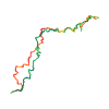
Ski tour · Como. The published line is 14.5 km long.
Map layers
Take the route with you
Download GPX ↓Original route geometry with estimated elevations from our terrain model. No account or app required.
ODbL 1.0 + CC BY-SA 3.0 FR · Licence. Source credits are included in the file.
- Highest point
- ≈ 2,077 m
Source directions
## Salita
Dal parcheggio sopra la diga, si segue la strada (800m) raggiungendo il **Ponte delle Seghe 654 m** (possibile transito in auto, piccolo parcheggio).
Dal Ponte delle Seghe si sale a piedi oltrepassando il ponte ad arco romano e continuando per mulattiera oppure si raggiunge il successivo ponte, più largo e carrabile, e si sale per carrareccia sci ai piedi.
Si passa da **Ponte 861 m**, e poco prima di raggiungere **Madèe 973 m** deviare a destra su mulattiera, oltrepassare la frazione di Motta 963 m e a quota 1000 m circa salire i pendii sopra l'abitato di Cimuze 984 m tenere leggermente la destra passando dall'**Alpe di Gordia 1391 m**; continuare fino ad un pianoro, proseguire a destra puntando il **Dosso di Gromo 1755 m** che è facilmente raggiungibile con gli sci ai piedi con 50 m di dislivello per il dossone del versante S dalla baita dell'**Alpe di Corte di Mezzo 1702 m**, altrimenti lasciandoli sulla destra, aggirare la dorsale dopo la baita, salire per dossi talvolta ripidi passando da una selletta a S della quota **1914 m** in seguito risalire la valletta finale e raggiunta la sella di quota **1997 m** per il facile dossone finale in direzione WSW si raggiunge la cima del **Monte Tabor 2079 m** con gli sci ai piedi.
## Discesa
per l'itinerario di salita
The map shows the published line. Provider ascent and descent retain their original meaning; estimates along the line are marked ≈. An additional return route is not automatically included in the line. Elevation profile estimated from Copernicus DEM. Provider statistics may differ.
Weather · next 48 hours
Loading weather …
BULLETIN
Avalanche bulletins along this route
No EUREGIO bulletin region is assigned to this line.
Check the official report for current danger and validity. Avalanche warning services
Regional avalanche bulletins do not assess an individual route. Check validity, elevation and aspect.
NATUR · NATURE
Protected areas along the route
No protected area was found along this line in the available dataset. Follow local notices.
Open on your iPhone · QR
Source & data
Camptocamp · José Picheral, Giovanni Rovedatti, cimaxi, L. Besson, rabot · https://www.camptocamp.org/routes/148632 · Coordinates reprojected; DEM elevation estimates · ODbL 1.0 + CC BY-SA 3.0 FR
Camptocamp · 2017-12-27T08:31:08.178633+00:00
Produced using Copernicus WorldDEM-30 © DLR e.V. 2010-2014 and © Airbus Defence and Space GmbH 2014-2018 provided under COPERNICUS by the European Union and ESA; all rights reserved.
Tour-ID: c2c:route/148632 · Revision: c6e5c4e025bc