
GeoSphere Austria · sources
Elevation profile
Snow depth
Model · 1 kmLoading snow model …
- Distance
- 11.3 km
- Ascent
- 1,270 m
- Descent from source
- 1,270 m
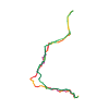
Ski tour · Kanton Uri. The published line is 11.3 km long.
Map layers
Take the route with you
Download GPX ↓Original route geometry with estimated elevations from our terrain model. No account or app required.
ODbL 1.0 + CC BY-SA 3.0 FR · Licence. Source credits are included in the file.
- Highest point
- ≈ 3,005 m
Source directions
Dal parcheggio della diga del Goscheneralpsee (raggiungibile solo a fine stagione) salire alla diga e attraversarla per portarsi ad Alpergen con un traverso a picco sul lago, senza neve c'e' un sentierino, ma con neve pericolosa o molto dura va valutato bene, puo' essere piu' sicuro scendere al livello del lago per poi risalire per la massima pendenza.Da qui risalire i ripidi pendii attraverso Alpergenplatten fino quasi alla quota 2511m, ci si separa dall'itinerario, fin qui comune, al [[waypoints/40477|Lochberg]], dirigersi ora nell'evidente vallone che si apre a sinistra tra caratteristiche guglie granitiche,risalirlo interamente piegando leggermente a destra nella parte alta.Lasciati gli sci nel punto piu' alto raggiungibile seguire la cresta di sinistra (cresta W del Müeterlishorn E) meglio sul lato sud dove si presenta perlopiu' nevosa.
Source safety information
Poco sviluppo.
I pendii della gita sono sempre sostenuti ma mai ripidissimi, permettono una sciata continua e di soddisfazione.
Vallone superiore incassato e esposto a nordovest, prende il sole tardi.
Source equipment information
Eventualmente piccozza e ramponi per la cresta.
Source directions
##Montée
Du Barrage se diriger vers le S et emprunter le sentier d'été jusqu'au premier ruisseau.
De là, monter les pentes raides jusqu'à Älpergensee (2500 m).
Se diriger vers l'E et s'engager dans le vallon. Contourner l'éperon issu du sommet principal du Müeterlishorn et monter vers le col où l'on dépose les skis.
Gravir les rochers faciles de l'arête jusqu'au sommet.
##Descente
Par le même itinéraire.
Source safety information
* Pentes raides où l'on gagne rapidement de l'altitude.
Source equipment information
* couteaux utiles
The map shows the published line. Provider ascent and descent retain their original meaning; estimates along the line are marked ≈. An additional return route is not automatically included in the line. Elevation profile estimated from Copernicus DEM. Provider statistics may differ.
Weather · next 48 hours
Loading weather …
BULLETIN
Avalanche bulletins along this route
Bulletin regions along this line: Northern Urseren
Regional avalanche bulletins do not assess an individual route. Check validity, elevation and aspect.
NATUR · NATURE
Protected areas along the route
No protected area was found along this line in the available dataset. Follow local notices.
Open on your iPhone · QR
Source & data
Camptocamp · Camptocamp-Association, Céline Stern-Kiener, Franco Pecchio, Giancarlo Langini, rabot, botopo · https://www.camptocamp.org/routes/49524 · Coordinates reprojected; DEM elevation estimates · ODbL 1.0 + CC BY-SA 3.0 FR
Camptocamp · 2018-12-21T05:22:58.465026+00:00
Produced using Copernicus WorldDEM-30 © DLR e.V. 2010-2014 and © Airbus Defence and Space GmbH 2014-2018 provided under COPERNICUS by the European Union and ESA; all rights reserved.
Tour-ID: c2c:route/49524 · Revision: 1f35bb33958c