
GeoSphere Austria · sources
Elevation profile
Snow depth
Model · 1 kmLoading snow model …
- Distance
- 9.9 km
- Ascent
- 1,127 m
- Descent from source
- 1,127 m
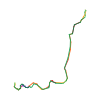
Ski tour · Kanton Graubünden. The published line is 9.9 km long.
Map layers
Take the route with you
Download GPX ↓Original route geometry with estimated elevations from our terrain model. No account or app required.
ODbL 1.0 + CC BY-SA 3.0 FR · Licence. Source credits are included in the file.
- Highest point
- ≈ 3,166 m
Source directions
[img=886912 right/]
Dal parcheggio della funivia del Diavolezza 2080 m si risalgono le piste da sci fin poco sotto la partenza della seggiovia a quota 2700 m circa, ci si porta ora in direzione W alla base della parete NE del Munt Pers che è solcata da tre canali, si sale quello di destra che termina alla sella tra la quota 3141 m e il Mont Pers, il canale 300 metri di dislivello presenta una pendenza costante attorno ai 40°, giunti al colle si prosegue per la dorsale SE fino alla cima.
Discesa per la via di salita.
Richiede neve assestata e che la parete NE del Munt Pers abbia già scaricato.
Source safety information
Canale non particolarmente ripido, ma da non sottovalutare per la presenza di salti di roccia che potrebbero essere pericolosi nell’eventualità di una scivolata, è inoltre esposto a eventuali scariche della parete NE del Munt Pers.
Source equipment information
Piccozza e ramponi.
The map shows the published line. Provider ascent and descent retain their original meaning; estimates along the line are marked ≈. An additional return route is not automatically included in the line. Elevation profile estimated from Copernicus DEM. Provider statistics may differ.
Weather · next 48 hours
Loading weather …
BULLETIN
Avalanche bulletins along this route
Bulletin regions along this line: Bernina
Regional avalanche bulletins do not assess an individual route. Check validity, elevation and aspect.
NATUR · NATURE
Protected areas along the route
No protected area was found along this line in the available dataset. Follow local notices.
Open on your iPhone · QR
Source & data
Camptocamp · Edoardo Satiro, berus, Antoine Marnat · https://www.camptocamp.org/routes/886911 · Coordinates reprojected; DEM elevation estimates · ODbL 1.0 + CC BY-SA 3.0 FR
Camptocamp · 2020-10-30T08:26:37.242497+00:00
Produced using Copernicus WorldDEM-30 © DLR e.V. 2010-2014 and © Airbus Defence and Space GmbH 2014-2018 provided under COPERNICUS by the European Union and ESA; all rights reserved.
Tour-ID: c2c:route/886911 · Revision: 8170c8b6c8a4