
GeoSphere Austria · sources
Elevation profile
Snow depth
Model · 1 kmLoading snow model …
- Distance
- 10.5 km
- Ascent
- 1,580 m
- Descent from source
- 1,580 m
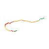
Ski tour · Kanton Wallis. The published line is 10.5 km long.
Map layers
Take the route with you
Download GPX ↓Original route geometry with estimated elevations from our terrain model. No account or app required.
ODbL 1.0 + CC BY-SA 3.0 FR · Licence. Source credits are included in the file.
- Highest point
- ≈ 3,790 m
Source directions
##Montée # 7h de la cabane, 1h30 pour l'arête
Descendre les échelles de la cabane Oberaletsch et partir en direction de l'W pour longer le Beichgletscher dans toute sa longueur, 5 bons km!
La véritable montée débute sous le Lonzahörner vers 2900 m. Contrairement à la carte 1:50000, il est préférable de frôler la base de l'arête E du Lonzahörner qui permet d'éviter de nombreuses crevasses. Remonter ensuite entre les séracs (Attention à leur stabilité!) jusqu'à 3300 m.
Continuer dans la même direction (SW) jusqu'à 3500 m, puis bifurquer à gauche pour rejoindre le Gredetschjoch (3508 m). Ce détour permet d'éviter aussi de grosses crevasses.
De là, suivre intégralement l'arête qui débute par de petits rochers entremêlés de neige. Arête aérienne exposée. Attention, le sommet n'est pas la première bosse que l'on atteint (3720 m) mais la seconde (3822 m) .
##Descente
Arête en sens inverse. Retour à la cabane en empruntant à peu près le chemin de montée.
Remontée pénible à la cabane!
Source safety information
* Attention aux crevasses !
* Tracé GPS en date du 5 mai 2016.
The map shows the published line. Provider ascent and descent retain their original meaning; estimates along the line are marked ≈. An additional return route is not automatically included in the line. Elevation profile estimated from Copernicus DEM. Provider statistics may differ.
Weather · next 48 hours
Loading weather …
BULLETIN
Avalanche bulletins along this route
Bulletin regions along this line: Konkordia region
Regional avalanche bulletins do not assess an individual route. Check validity, elevation and aspect.
NATUR · NATURE
Protected areas along the route
Alpjuhorn
Bundesinventar der eidgenössischen Jagdbanngebiete
Kartendarstellung vereinfacht; maßgeblich ist die verlinkte Originalquelle.
Open on your iPhone · QR
Source & data
Camptocamp · Céline Stern-Kiener, Philippe Wack, Jean-Louis Pitteloud, J-Marc, rabot, botopo · https://www.camptocamp.org/routes/154410 · Coordinates reprojected; DEM elevation estimates · ODbL 1.0 + CC BY-SA 3.0 FR
Camptocamp · 2023-05-19T08:48:28.067876+00:00
Produced using Copernicus WorldDEM-30 © DLR e.V. 2010-2014 and © Airbus Defence and Space GmbH 2014-2018 provided under COPERNICUS by the European Union and ESA; all rights reserved.
Tour-ID: c2c:route/154410 · Revision: cf9694939b02