
GeoSphere Austria · sources
Ski tours · Kanton Uri
Oberalpstock · Traversata Etzlihutte → Maderanertal per lo Staldenfirn
Elevation profile
Snow depth
Model · 1 kmLoading snow model …
- Distance
- 15.8 km
- Ascent
- 1,522 m
- Descent from source
- 2,742 m
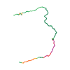
Ski tour · Kanton Uri. The published line is 15.8 km long.
Map layers
Take the route with you
Download GPX ↓Original route geometry with estimated elevations from our terrain model. No account or app required.
ODbL 1.0 + CC BY-SA 3.0 FR · Licence. Source credits are included in the file.
- Highest point
- ≈ 3,263 m
Source directions
Dalla Etzlihutte scendere in località Mullersmatt, messe le pelli si risale in direzione E la Chruzlital fino al Chruzlipass (2346). Da questo punto si scende fino a 2100 m in val Strem per poi risalire sempre in direzione E uno spallone piuttosto ripido posto tra due canalini, da qui i pendii si fanno più dolci, a circa 2350 m si punta a NE e senza traccia obbligata si punta la Fuorcla da Strem Sura (3112). Si procede verso la punta della bastionata rocciosa che scende dall’Oberalpstock e con un paio di traversi si sale in cima.
Per la discesa vedi l'itinerario associato.
Source safety information
Se la discesa è in prima traccia è fondamentale trovare il punto esatto del traverso
The map shows the published line. Provider ascent and descent retain their original meaning; estimates along the line are marked ≈. An additional return route is not automatically included in the line. Elevation profile estimated from Copernicus DEM. Provider statistics may differ.
Weather · next 48 hours
Loading weather …
BULLETIN
Avalanche bulletins along this route
Bulletin regions along this line: Maderanertal
Regional avalanche bulletins do not assess an individual route. Check validity, elevation and aspect.
NATUR · NATURE
Protected areas along the route
Stössi
Bundesinventar der Auengebiete von nationaler Bedeutung
Kartendarstellung vereinfacht; maßgeblich ist die verlinkte Originalquelle.
Chärstelenbach, Stössi
Waldreservate
Kartendarstellung vereinfacht; maßgeblich ist die verlinkte Originalquelle.
Open on your iPhone · QR
Source & data
Camptocamp · J-Marc, Marco Busti · https://www.camptocamp.org/routes/1097082 · Coordinates reprojected; DEM elevation estimates · ODbL 1.0 + CC BY-SA 3.0 FR
Camptocamp · 2025-07-26T09:50:03.587826+00:00
Produced using Copernicus WorldDEM-30 © DLR e.V. 2010-2014 and © Airbus Defence and Space GmbH 2014-2018 provided under COPERNICUS by the European Union and ESA; all rights reserved.
Tour-ID: c2c:route/1097082 · Revision: 7012cafeffa5