
GeoSphere Austria · sources
Elevation profile
Snow depth
Model · 1 kmLoading snow model …
- Distance
- 12.1 km
- Ascent
- 1,750 m
- Descent from source
- 1,750 m
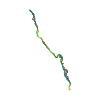
Ski tour · Bergamo. The published line is 12.1 km long.
Map layers
Take the route with you
Download GPX ↓Original route geometry with estimated elevations from our terrain model. No account or app required.
ODbL 1.0 + CC BY-SA 3.0 FR · Licence. Source credits are included in the file.
- Highest point
- ≈ 2,639 m
Source directions
All' uscita del paese di Valbondione in direzione della funivia dell' Enel, poco oltre il primo incrocio, prendere il sentiero 301 che scende sulla sinistra al ponticello q. 910m e risale ripido al Rifugio Coca (1892m). Senza raggiungere il rifugio proseguire o per sentiero o nel fondo del vallone in direzione nord verso il Laghetto di Coca (q. 2100 circa), oltrepassarlo (meglio a sinistra, meno ripido) e arrivare ai piedi dell' evidente e regolare pendio sud-est che con circa 500m di dislivello porta direttamente al passo. Nell' ultimo tratto puo' essere necessario togliere gli sci e proseguire a piedi o su neve o sulle roccette sulla destra del pendio in genere libere da neve.
Source safety information
Gita da effetuarsi preferibilmente con assenza di neve fin verso 1800m.
Source equipment information
Ramponi
The map shows the published line. Provider ascent and descent retain their original meaning; estimates along the line are marked ≈. An additional return route is not automatically included in the line. Elevation profile estimated from Copernicus DEM. Provider statistics may differ.
Weather · next 48 hours
Loading weather …
BULLETIN
Avalanche bulletins along this route
No EUREGIO bulletin region is assigned to this line.
Check the official report for current danger and validity. Avalanche warning services
Regional avalanche bulletins do not assess an individual route. Check validity, elevation and aspect.
NATUR · NATURE
Protected areas along the route
No protected area was found along this line in the available dataset. Follow local notices.
Open on your iPhone · QR
Source & data
Camptocamp · Paolo Recalcati · https://www.camptocamp.org/routes/224386 · Coordinates reprojected; DEM elevation estimates · ODbL 1.0 + CC BY-SA 3.0 FR
Camptocamp · 2010-06-23T15:25:52.410973+00:00
Produced using Copernicus WorldDEM-30 © DLR e.V. 2010-2014 and © Airbus Defence and Space GmbH 2014-2018 provided under COPERNICUS by the European Union and ESA; all rights reserved.
Tour-ID: c2c:route/224386 · Revision: c6ccfc2948cb