
GeoSphere Austria · sources
Elevation profile
Snow depth
Model · 1 kmLoading snow model …
- Distance
- 10.4 km
- Ascent
- 1,254 m
- Descent from source
- 1,254 m
Ski tour · Cuneo. The published line is 10.4 km long.
Map layers
Take the route with you
Download GPX ↓Original route geometry with estimated elevations from our terrain model. No account or app required.
ODbL 1.0 + CC BY-SA 3.0 FR · Licence. Source credits are included in the file.
- Highest point
- ≈ 2,951 m
Source directions
Dal ponte a quota 1738 (tra Chiazale e S.Anna di Bellino- cartello segnalatore con indicazione per Colle delle Sagneres) attraversare il torrente e portarsi in piano su ampi prati verso un ponticello che si attraversa nuovamente; tenersi a sx del torrente per terreno boschivo rado fino ad una baita ristrutturata; continuare dalla stessa parte ancora per qualche centinaio di mt per poi portarsi a dx dove inizia un lungo tratto a moderata pendenza che porta circa a quota 2100 da dove sulla dx inizia un pendio più ripido ( sotto pareti strapiombanti - attenzione a valanghe dall'alto) che si risale fino al termine per poi effettuare un traverso verso sx che porta su un breve pendio canale che sbuca su un falsopiano; da qui aggirare sulla dx un evidente dosso ripido per un valloncello a moderata pendenza quindi ritornare a sx per pendio ripido per arrivare al culmine del predetto dosso; da qui in semipiano raggiungere a quota 2500 mt l'inizio dell'ampio ma ripido canalone (circa 400-500 mt) che , dopo una impennata a metà , porta al Colle delle Sagneres (2894 mt); percorrere brevemente lo spartiacque Valle Varaita- Valle Maira fino all'ampio e moderatamente ripido pendio finale che si percorre senza problemi (spesso ventato, o con pietre affioranti) fino all'ometto di vetta.
Source safety information
* spostamento praticamente nullo; salita efficacissima
* pendii sostenuti nel complesso; il canalone è ripido ma ben raccordato
* il pendio finale è orientato a Est
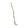
The map shows the published line. Provider ascent and descent retain their original meaning; estimates along the line are marked ≈. An additional return route is not automatically included in the line. Elevation profile estimated from Copernicus DEM. Provider statistics may differ.
Weather · next 48 hours
Loading weather …
BULLETIN
Avalanche bulletins along this route
No EUREGIO bulletin region is assigned to this line.
Check the official report for current danger and validity. Avalanche warning services
Regional avalanche bulletins do not assess an individual route. Check validity, elevation and aspect.
NATUR · NATURE
Protected areas along the route
No protected area was found along this line in the available dataset. Follow local notices.
Open on your iPhone · QR
Source & data
Camptocamp · Camptocamp-Association, BertrandSemelet, José Picheral, cimaxi · https://www.camptocamp.org/routes/48872 · Coordinates reprojected; DEM elevation estimates · ODbL 1.0 + CC BY-SA 3.0 FR
Camptocamp · 2023-03-02T17:58:27.823217+00:00
Produced using Copernicus WorldDEM-30 © DLR e.V. 2010-2014 and © Airbus Defence and Space GmbH 2014-2018 provided under COPERNICUS by the European Union and ESA; all rights reserved.
Tour-ID: c2c:route/48872 · Revision: 7055d3672fef