
GeoSphere Austria · sources
Elevation profile
Snow depth
Model · 1 kmLoading snow model …
- Distance
- 11.8 km
- Ascent
- 1,285 m
- Descent from source
- 1,285 m
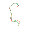
Ski tour · Kanton Graubünden. The published line is 11.8 km long.
Map layers
Take the route with you
Download GPX ↓Original route geometry with estimated elevations from our terrain model. No account or app required.
ODbL 1.0 + CC BY-SA 3.0 FR · Licence. Source credits are included in the file.
- Highest point
- ≈ 2,731 m
Source directions
## Salita
da Casaccia 1458 m, si sale in direzione Sud a sinistra di un piccolo skilift fino ad incrociare una strada forestale che si segue fino a quota 1751 m; superato un ponticello, si risalgono a destra i ripidi pendii fino ad incrociare il sentiero che a destra porta alla baita Alpascela 2074 m. Si continua sempre in direzione Nord per il bel vallone su pendii all’inizio più moderati ma via via più ripidi; si passa a sinistra di un caratteristico sassone e si entra in un canalino stretto e ripido fino all’intaglio tra il Piz dal Sasc (a destra) e la quota 2464 (a sinistra). Si percorre ora il piano dell'Alpascelin e con un ampio giro verso destra si risalgono i bei pendii Nord-Ovest fino alla vetta.
## Discesa
Consigliata la discesa per i ripidi canali a sinistra scendendo della traccia di salita. Canali con tratti a 40/45°, ben visibili sulla destra durante la salita. Data l'esposizione Sud-Ovest la neve su questi pendii in genere risulta migliore.
Source safety information
Itinerario interessante che permette di salire la conca di Alpascela, poco conosciuta e frequentata.
Presenta molti tratti ripidi e necessita di neve ben assestata.
Source equipment information
Utili i ramponi
The map shows the published line. Provider ascent and descent retain their original meaning; estimates along the line are marked ≈. An additional return route is not automatically included in the line. Elevation profile estimated from Copernicus DEM. Provider statistics may differ.
Weather · next 48 hours
Loading weather …
BULLETIN
Avalanche bulletins along this route
Bulletin regions along this line: Val Bregaglia
Regional avalanche bulletins do not assess an individual route. Check validity, elevation and aspect.
NATUR · NATURE
Protected areas along the route
No protected area was found along this line in the available dataset. Follow local notices.
Open on your iPhone · QR
Source & data
Camptocamp · Gianluca Moroni, cimaxi, berus · https://www.camptocamp.org/routes/266968 · Coordinates reprojected; DEM elevation estimates · ODbL 1.0 + CC BY-SA 3.0 FR
Camptocamp · 2020-01-08T19:08:58.009480+00:00
Produced using Copernicus WorldDEM-30 © DLR e.V. 2010-2014 and © Airbus Defence and Space GmbH 2014-2018 provided under COPERNICUS by the European Union and ESA; all rights reserved.
Tour-ID: c2c:route/266968 · Revision: abbda25f8243