
GeoSphere Austria · sources
Elevation profile
Snow depth
Model · 1 kmLoading snow model …
- Distance
- 5.6 km
- Ascent
- 1,540 m
- Descent from source
- 1,465 m
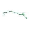
Ski tour · Kanton Tessin. The published line is 5.6 km long.
Map layers
Take the route with you
Download GPX ↓Original route geometry with estimated elevations from our terrain model. No account or app required.
ODbL 1.0 + CC BY-SA 3.0 FR · Licence. Source credits are included in the file.
- Highest point
- ≈ 2,277 m
Source directions
Da Buseno si segue la carrozzabile che passando da Fontana raggiunge i Monti di San Carlo (1190m). Si attraversano le cascine per puntare al bosco sempre verso ovest quindi prendere il sentiero segnalato CAS. A quota 1540 si incontra una piccola radura dove proviene anche il sentiero dall Alp di Palazi, da qui proseguire in direzione NW verso il Rio de Carnac. Il bosco progressivamente si apre indi si punta traversando in direzione NW verso la conca del rio. Di fronte si erge evidente la parete ovest del Molinera e viene naturale incanalarsi verso la sella e uscire in cresta a quota 2175 da cui lungo la facile cresta si arriva in vetta sci ai piedi.
Source safety information
Itinerario poco frequentato ma di notevole bellezza. Il sacrificio della stradina iniziale fino San Carlo viene ben ripagato dal bosco e dai pendi superiori dove ammirare suggestivi e ampi panorami e dedicarsi a discese sciistiche assai remunerative.
Attenzione alla poca disponibilita di parcheggio a Buseno e sopprattutto a non disturbare la popolazione locale molto tranquilla e quindi poco propensa ad accogliere invasioni di turisti.
The map shows the published line. Provider ascent and descent retain their original meaning; estimates along the line are marked ≈. An additional return route is not automatically included in the line. Elevation profile estimated from Copernicus DEM. Provider statistics may differ.
Weather · next 48 hours
Loading weather …
BULLETIN
Avalanche bulletins along this route
Bulletin regions along this line: Riviera, Basso Moesano
Regional avalanche bulletins do not assess an individual route. Check validity, elevation and aspect.
NATUR · NATURE
Protected areas along the route
Fontana
Bundesinventar der Trockenwiesen und -weiden von nationaler Bedeutung
Kartendarstellung vereinfacht; maßgeblich ist die verlinkte Originalquelle.
Monti di San Carlo
Bundesinventar der Trockenwiesen und -weiden von nationaler Bedeutung
Kartendarstellung vereinfacht; maßgeblich ist die verlinkte Originalquelle.
Open on your iPhone · QR
Source & data
Camptocamp · Céline Stern-Kiener, cimaxi, Andrea Fontana · https://www.camptocamp.org/routes/493887 · Coordinates reprojected; DEM elevation estimates · ODbL 1.0 + CC BY-SA 3.0 FR
Camptocamp · 2020-05-27T20:21:10.785611+00:00
Produced using Copernicus WorldDEM-30 © DLR e.V. 2010-2014 and © Airbus Defence and Space GmbH 2014-2018 provided under COPERNICUS by the European Union and ESA; all rights reserved.
Tour-ID: c2c:route/493887 · Revision: 5db281ecbf93