
GeoSphere Austria · sources
Elevation profile
Snow depth
Model · 1 kmLoading snow model …
- Distance
- 8.8 km
- Ascent
- 1,250 m
- Descent from source
- 1,524 m
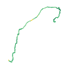
Ski tour · Kanton Graubünden. The published line is 8.8 km long.
Map layers
Take the route with you
Download GPX ↓Original route geometry with estimated elevations from our terrain model. No account or app required.
ODbL 1.0 + CC BY-SA 3.0 FR · Licence. Source credits are included in the file.
- Highest point
- ≈ 2,835 m
Source directions
Dalla chiesa di San Bernardino si sale senza percorso obbligato lasciando a destra i piloni dello skilift e dirigendosi verso nord fino a imboccare la val Vignun. Fin qui si tratta dello stesso itinerario per il Pizzo Uccello. Si percorre la Val Vignun tra saliscendi e prima della quota 2326m, Strec de Vignun, si inverte quasi la direzione (fin qui è lo stesso itinerario per il Piz Lumbreida iniziando a salire su pendii ripidi intervallati da terrazze e fasce rocciose in direzione S e poi SO. Quando il pendio finalmente si adagia, quota 2600 circa, si vede sulla sinistra la croce di vetta del Piz Vignun, in breve la si raggiunge compiendo un semicerchio in senso antiorario in un piccolo anfiteatro. Si sale in cresta e si arriva in vetta per facili roccette.
Source safety information
Itinerario poco frequentato ma molto interessante, più abbordabile del vicino Lumbreida. Dopo il lungo pianone da Strec de Vignun alla vetta l'itinerario si fa molto appagante anche dal punto di vista sciistico, pendii sostenuti, conche e canaloni esposti a nord. Comunque sviluppo piuttosto lungo, 8.50 km circa, adatto a chi sa apprezzare anche i lunghi ma suggestivi falsipiani.
The map shows the published line. Provider ascent and descent retain their original meaning; estimates along the line are marked ≈. An additional return route is not automatically included in the line. Elevation profile estimated from Copernicus DEM. Provider statistics may differ.
Weather · next 48 hours
Loading weather …
BULLETIN
Avalanche bulletins along this route
Bulletin regions along this line: Alto Moesano
Regional avalanche bulletins do not assess an individual route. Check validity, elevation and aspect.
NATUR · NATURE
Protected areas along the route
Val Vignun
Pflanzenschutzgebiet
Pflanzen sammeln
Pflanzen sammeln ist verboten.
Digitize the Planet · CC0 1.0 · Hinweise
Amt für Landwirtschaft und Geoinformation - Graubünden · opendata.swiss BY
BR 496.100 - Kantonale Natur- und Heimatschutzverordnung (KNHV) ·
Kartendarstellung vereinfacht; maßgeblich ist die verlinkte Originalquelle.
Open on your iPhone · QR
Source & data
Camptocamp · Andrea Fontana · https://www.camptocamp.org/routes/421998 · Coordinates reprojected; DEM elevation estimates · ODbL 1.0 + CC BY-SA 3.0 FR
Camptocamp · 2013-05-01T22:21:44.184951+00:00
Produced using Copernicus WorldDEM-30 © DLR e.V. 2010-2014 and © Airbus Defence and Space GmbH 2014-2018 provided under COPERNICUS by the European Union and ESA; all rights reserved.
Tour-ID: c2c:route/421998 · Revision: f6b22bb0430b