
GeoSphere Austria · sources
Ski tours · Verbano-Cusio-Ossola
Pizzo Camino · da Rumianca per la cresta est dell'alpe La Crosa
Elevation profile
Snow depth
Model · 1 kmLoading snow model …
- Distance
- 9.4 km
- Ascent
- 1,912 m
- Descent from source
- 1,912 m
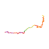
Ski tour · Verbano-Cusio-Ossola. The published line is 9.4 km long.
Map layers
Take the route with you
Download GPX ↓Original route geometry with estimated elevations from our terrain model. No account or app required.
ODbL 1.0 + CC BY-SA 3.0 FR · Licence. Source credits are included in the file.
- Highest point
- ≈ 2,074 m
Source directions
Da Rumianca, abitato tra anzola d'ossola e pieve vergonte,prendere la gippabile che con direz. sud raggiunge l'alpe Agalit.Da qui proseguire con direz.ovest sulla mulattiera verso l'alpe Mazzucchero. Poco prima di giungere a quest'ultima prestare attenzione ad una cascata ghiacciata che é possibile passare scendendo nella valletta (si perdono circa 70/80 mt. di dislivello) per poi risalire lungo la dorsale est fino all'alpe Mazzucchero.si prosegue sulla dorsale (inizialmente con bosco un pò fitto) fino a sbucare in un'ampia conca.Tenersi sulla destra fino all'alpe La Crosa, guadagnando la cresta est. Da qui continuare fino in vetta (alcuni tratti con sci nello zaino). Discesa per il vallone nord-est fino all'alpe la Piana poi in traverso verso destra (sud-est) riguadagnare la dorsale sopra l'alpe Mazzucchero. Riprendere poi la medesima traccia di salita.
Source safety information
Itinerario molto lungo di circa 20 km di sviluppo A/R e tra sali e scendi un aumento del dislivello a circa 2100 mt.Limite della neve a quota circa 700 mt. Nonostante il parecchio tempo con gli sci a spalla a causa dell'assenza di neve e dei passaggi un pò stretti é comunque una gita di gran soddisfazione con un bellissimo panorama dalla vetta.
Source equipment information
Possono servire i ramponi
The map shows the published line. Provider ascent and descent retain their original meaning; estimates along the line are marked ≈. An additional return route is not automatically included in the line. Elevation profile estimated from Copernicus DEM. Provider statistics may differ.
Weather · next 48 hours
Loading weather …
BULLETIN
Avalanche bulletins along this route
No EUREGIO bulletin region is assigned to this line.
Check the official report for current danger and validity. Avalanche warning services
Regional avalanche bulletins do not assess an individual route. Check validity, elevation and aspect.
NATUR · NATURE
Protected areas along the route
No protected area was found along this line in the available dataset. Follow local notices.
Open on your iPhone · QR
Source & data
Camptocamp · Matteo Donati, L. Besson, botopo · https://www.camptocamp.org/routes/157039 · Coordinates reprojected; DEM elevation estimates · ODbL 1.0 + CC BY-SA 3.0 FR
Camptocamp · 2018-07-29T12:37:23.642097+00:00
Produced using Copernicus WorldDEM-30 © DLR e.V. 2010-2014 and © Airbus Defence and Space GmbH 2014-2018 provided under COPERNICUS by the European Union and ESA; all rights reserved.
Tour-ID: c2c:route/157039 · Revision: 569c6639d718