
GeoSphere Austria · sources
Elevation profile
Snow depth
Model · 1 kmLoading snow model …
- Distance
- 7.7 km
- Ascent
- 1,335 m
- Descent from source
- 1,335 m
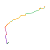
Ski tour · Kanton Tessin. The published line is 7.7 km long.
Map layers
Take the route with you
Download GPX ↓Original route geometry with estimated elevations from our terrain model. No account or app required.
ODbL 1.0 + CC BY-SA 3.0 FR · Licence. Source credits are included in the file.
- Highest point
- ≈ 2,572 m
Source directions
Da Cimalmotto portarsi al Piano della Stufa perdendo circa 50 metri di quota lungo una stradina, continuare sul fondovalle (meglio sx orografica) fino a quota 1500 metri circa da dove appare il canalone N del Pizzo dell'Alpe Gelato. Sono sin qui circa 4 Km di solo spostamento. Il canalone in basso è di fatto una gola poco ripida, sopra si entra nella parte alta rettilinea e più sostenuta, max quasi 40° per breve tratto, fino alla bocchetta sopra il lago Gelato, girare a sx e per ripido pendio esposto a sud-ovest si arriva in vetta.
Source safety information
Itinerario molto interessante in ambiente selvaggio, il canalone necessità buon riempimento, ma troppo avanti in stagione è facile trovarlo slavinato, non è visibile fino all'ultimo, occorre provarci !!!
The map shows the published line. Provider ascent and descent retain their original meaning; estimates along the line are marked ≈. An additional return route is not automatically included in the line. Elevation profile estimated from Copernicus DEM. Provider statistics may differ.
Weather · next 48 hours
Loading weather …
BULLETIN
Avalanche bulletins along this route
Bulletin regions along this line: Upper Valle Maggia
Regional avalanche bulletins do not assess an individual route. Check validity, elevation and aspect.
NATUR · NATURE
Protected areas along the route
Mött di Tirman
Bundesinventar der Auengebiete von nationaler Bedeutung
Kartendarstellung vereinfacht; maßgeblich ist die verlinkte Originalquelle.
Open on your iPhone · QR
Source & data
Camptocamp · Frédéric Bunoz, cimaxi, Riccardo Vairetti, Cpamoa · https://www.camptocamp.org/routes/121937 · Coordinates reprojected; DEM elevation estimates · ODbL 1.0 + CC BY-SA 3.0 FR
Camptocamp · 2016-04-05T23:14:04.645057+00:00
Produced using Copernicus WorldDEM-30 © DLR e.V. 2010-2014 and © Airbus Defence and Space GmbH 2014-2018 provided under COPERNICUS by the European Union and ESA; all rights reserved.
Tour-ID: c2c:route/121937 · Revision: 54873a853611