
GeoSphere Austria · sources
Elevation profile
Snow depth
Model · 1 kmLoading snow model …
- Distance
- 20.7 km
- Ascent
- 1,636 m
- Descent from source
- 1,636 m
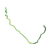
Ski tour · Turin. The published line is 20.7 km long.
Map layers
Take the route with you
Download GPX ↓Original route geometry with estimated elevations from our terrain model. No account or app required.
ODbL 1.0 + CC BY-SA 3.0 FR · Licence. Source credits are included in the file.
- Highest point
- ≈ 3,250 m
Source directions
Da Ruilles si percorre la Valle di Thuras seguendo la strada militare. Superata Thuras inf. q.1948 si attraversa il torrente Thùres sul ponte e si prosegue sulla sx idrografica. Si supera Gr. Thuras sup. q.2071 e si sale nella valle fino a q. 2200 ca. Si riattraversa il torrente e si salgono i soprastanti ripidi pendii del Rio Serpentiera per circa 300m di dislivello. Seguire il vallone fino al più ripido pendio del Colle del Pelvo q.3063. Si risale quindi la larga cresta finale che conduce alla Punta Clapiera.
Source safety information
Attraversa pendii sostenuti pericolosi per valanghe.
Source equipment information
Ramponi utili.
The map shows the published line. Provider ascent and descent retain their original meaning; estimates along the line are marked ≈. An additional return route is not automatically included in the line. Elevation profile estimated from Copernicus DEM. Provider statistics may differ.
Weather · next 48 hours
Loading weather …
BULLETIN
Avalanche bulletins along this route
No EUREGIO bulletin region is assigned to this line.
Check the official report for current danger and validity. Avalanche warning services
Regional avalanche bulletins do not assess an individual route. Check validity, elevation and aspect.
NATUR · NATURE
Protected areas along the route
No protected area was found along this line in the available dataset. Follow local notices.
Open on your iPhone · QR
Source & data
Camptocamp · Mathieu des Noes, gerry · https://www.camptocamp.org/routes/621456 · Coordinates reprojected; DEM elevation estimates · ODbL 1.0 + CC BY-SA 3.0 FR
Camptocamp · 2016-11-08T14:31:43.949140+00:00
Produced using Copernicus WorldDEM-30 © DLR e.V. 2010-2014 and © Airbus Defence and Space GmbH 2014-2018 provided under COPERNICUS by the European Union and ESA; all rights reserved.
Tour-ID: c2c:route/621456 · Revision: 3e93f7c73c22