
GeoSphere Austria · sources
Elevation profile
Snow depth
Model · 1 kmLoading snow model …
- Distance
- 11.0 km
- Ascent
- 771 m
- Descent from source
- 2,000 m
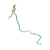
Ski tour · Vercelli. The published line is 11.0 km long.
Map layers
Take the route with you
Download GPX ↓Original route geometry with estimated elevations from our terrain model. No account or app required.
ODbL 1.0 + CC BY-SA 3.0 FR · Licence. Source credits are included in the file.
- Highest point
- ≈ 4,022 m
Source directions
E' il canale che scende sul ghiacciaio del Bors dalla vecchia piazzola dell'elicottero.
Dalla vetta della Punta giordani, scendere tenendo sulla sinistra il costone roccioso (attenzione ad eventuali lastroni di ghiaggio primaverili, in tal caso è conveniente aggirarli a destra). A 3900m la pendenza inizia ad aumentare,e si punta pian piano a sinistras entrando nel canale. Lo si scende interamente fino alla sottostante cengia nevosa, la quale da accesso al ghiacciaio del Bors tramite un traverso verso destra di 150m. Da qui un secondo canalino molto più corto da accesso ai pendii sottostanti.
Una volta giunti sui dolci pendii del ghiacciaio del Bors, si può scendere ad Alagna per uno qualsiasi degli itinerari freeride (Balma, Malfatta ecc) molto battuti durante tutto inverno, oppure rientrare a Pianalunga dalla Bocchetta delle Pisse.
Si scende passando di fianco alla vecchia stazione di Indren, si entra nel vallone della Balma e si punta alla bocchetta delle Pisse (lato destro idrografico della valle) cercando di non perdere troppo dislivello per via del lungo piano di rientro.
The map shows the published line. Provider ascent and descent retain their original meaning; estimates along the line are marked ≈. An additional return route is not automatically included in the line. Elevation profile estimated from Copernicus DEM. Provider statistics may differ.
Weather · next 48 hours
Loading weather …
BULLETIN
Avalanche bulletins along this route
No EUREGIO bulletin region is assigned to this line.
Check the official report for current danger and validity. Avalanche warning services
Regional avalanche bulletins do not assess an individual route. Check validity, elevation and aspect.
NATUR · NATURE
Protected areas along the route
Parco naturale dell’Alta Val Sesia e dell’Alta Val Strona
Parco naturale regionale/provinciale
Kartendarstellung vereinfacht; maßgeblich ist die verlinkte Originalquelle.
Open on your iPhone · QR
Source & data
Camptocamp · mello · https://www.camptocamp.org/routes/422261 · Coordinates reprojected; DEM elevation estimates · ODbL 1.0 + CC BY-SA 3.0 FR
Camptocamp · 2013-04-14T17:46:31.793647+00:00
Produced using Copernicus WorldDEM-30 © DLR e.V. 2010-2014 and © Airbus Defence and Space GmbH 2014-2018 provided under COPERNICUS by the European Union and ESA; all rights reserved.
Tour-ID: c2c:route/422261 · Revision: efc26cc83d9a