
GeoSphere Austria · sources
Elevation profile
Snow depth
Model · 1 kmLoading snow model …
- Distance
- 5.3 km
- Ascent
- 1,300 m
- Descent from source
- 1,300 m
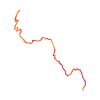
Ski tour · Sondrio. The published line is 5.3 km long.
Map layers
Take the route with you
Download GPX ↓Original route geometry with estimated elevations from our terrain model. No account or app required.
ODbL 1.0 + CC BY-SA 3.0 FR · Licence. Source credits are included in the file.
- Highest point
- ≈ 2,339 m
Source directions
## Salita
Dalla centrale dell'Armisa (**Cà Pizzini 1041m**), proseguire lungo la stradina per **Foppi**, fino al suo termine. Qui, deviare a sinistra per raggiungere le **Baite Moretti 1459m**. Continuare verso ESE su un ampio dosso, mantenendo alla sinistra la **Baita Campèi 1647m**; proseguire verso SSE fino a raggiungere un piano dove si trova una rada vegetazione. Qui, deviando verso NE ed evitando un ripido pendio, portarsi nella piccola valle sottostante la crestina che fa da spartiacque con la Val Malgina, nei pressi del Rifugio **Baita Pesciola 2004m**. Proseguendo nella valletta (SSE), si raggiunge la cresta spartiacque ad una evidente depressione (2150m circa); da essa, andando verso N, per l'elementare dorsale si raggiunge la vetta della *Pesciola* **2171m**.
### Variante
Raggiunta la sella spartiacque, invece di salire alla vetta vera e propria della Pesciola, si prosegue salendo nel canalone (alcuni passaggi sono ripidi), fino a raggiungere la caratteristica conca-vallone precedente il **Pizzo di Faila**. Quindi sci ai piedi si sale alla non ben definita **quota 2368m**. Essa rappresenta, ad ogni modo, il punto più elevato della caratteristica conca-vallone.
## Discesa
Per l'itinerario di salita.
Source safety information
Con il nome di "Pesciola", il curatore (Alfredo Corti) della Guida Monti d'Italia, Vol. Orobie, indicò la quota 2168 m, ora 2171 m. Tuttavia IGM colloca il toponimo presso la quota 2344 m. Gli scialpinisti sono soliti però raggiungere i pianori precedenti la cresta NW del Pizzo di Faila, nelle vicinanze quindi, della quota 2368m.
The map shows the published line. Provider ascent and descent retain their original meaning; estimates along the line are marked ≈. An additional return route is not automatically included in the line. Elevation profile estimated from Copernicus DEM. Provider statistics may differ.
Weather · next 48 hours
Loading weather …
BULLETIN
Avalanche bulletins along this route
No EUREGIO bulletin region is assigned to this line.
Check the official report for current danger and validity. Avalanche warning services
Regional avalanche bulletins do not assess an individual route. Check validity, elevation and aspect.
NATUR · NATURE
Protected areas along the route
No protected area was found along this line in the available dataset. Follow local notices.
Open on your iPhone · QR
Source & data
Camptocamp · Camptocamp-Association, Gianluca Moroni, Giovanni Rovedatti, Fabio Pola, cimaxi, Borut, itineralp, rabot, botopo · https://www.camptocamp.org/routes/48643 · Coordinates reprojected; DEM elevation estimates · ODbL 1.0 + CC BY-SA 3.0 FR
Camptocamp · 2025-02-12T15:36:39.010740+00:00
Produced using Copernicus WorldDEM-30 © DLR e.V. 2010-2014 and © Airbus Defence and Space GmbH 2014-2018 provided under COPERNICUS by the European Union and ESA; all rights reserved.
Tour-ID: c2c:route/48643 · Revision: bd1f739eb584