
GeoSphere Austria · sources
Elevation profile
Snow depth
Model · 1 kmLoading snow model …
- Distance
- 11.0 km
- Ascent
- 1,212 m
- Descent from source
- 1,212 m
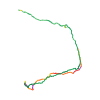
Ski tour · Trentino. The published line is 11.0 km long.
Map layers
Take the route with you
Download GPX ↓Original route geometry with estimated elevations from our terrain model. No account or app required.
ODbL 1.0 + CC BY-SA 3.0 FR · Licence. Source credits are included in the file.
- Highest point
- ≈ 2,606 m
Source directions
Da Pozza di Fassa (val di Fassa), in auto, abbandonata la statale principale dirigersi verso destra nella val San Nicolò fino a raggiungere l'arrivo degli impianti da sci o il rifugio Soldanella (parcheggio). Si prosegue verso continua con direzione sud-est inizialmente lungo la pista di rientro per poi, abbandonata la stessa, continuare con direzione sudt lungo la strada forestale che attraversando bei boschi di pini conduce alla Malga Monzoni (mt. 1820)(parecchi segnavia). Poco dopo la Malga Monzoni con direzione ovest prendere il ripido sentiero che senza alcuna difficoltà raggiunge il bellissimo rifugio Vallaccia (presenti segnavia)(mt.2275). Da qui si continua con direzione ovest che gradualmente conduce alla ben visibile Forcella La Costella (c.a.mt. 2500)(pendio sui 30/35° possibili valanghe). Guadagnata la forcella, ora con direzione nord-ovest, raggiungere la vettaa quota mt. 2637. Discesa per lo stesso itinerario.
Source safety information
Bell'itinerario invernale unico particolare è di prestare attenzione nel canale per raggiungere la forcella la Costela per possibilità di valanghe
The map shows the published line. Provider ascent and descent retain their original meaning; estimates along the line are marked ≈. An additional return route is not automatically included in the line. Elevation profile estimated from Copernicus DEM. Provider statistics may differ.
Weather · next 48 hours
Loading weather …
BULLETIN
Avalanche bulletins along this route
Bulletin regions along this line: Fassa Valley
Check the official report for current danger and validity. Avalanche warning services
Regional avalanche bulletins do not assess an individual route. Check validity, elevation and aspect.
NATUR · NATURE
Protected areas along the route
No protected area was found along this line in the available dataset. Follow local notices.
Open on your iPhone · QR
Source & data
Camptocamp · Fabien Quétier, Matteo Donati · https://www.camptocamp.org/routes/193944 · Coordinates reprojected; DEM elevation estimates · ODbL 1.0 + CC BY-SA 3.0 FR
Camptocamp · 2009-12-09T16:04:32.408297+00:00
Produced using Copernicus WorldDEM-30 © DLR e.V. 2010-2014 and © Airbus Defence and Space GmbH 2014-2018 provided under COPERNICUS by the European Union and ESA; all rights reserved.
Tour-ID: c2c:route/193944 · Revision: 29d40a00c610