
Elevation profile
- Distance
- 15.6 km
- Ascent
- 1,000 m
- Descent from source
- 1,000 m
Hike · Vorarlberg. The published line is 15.6 km long.
Map layers
Take the route with you
Download GPX ↓Original route geometry with estimated elevations from our terrain model. No account or app required.
CC BY 4.0 · Licence. Source credits are included in the file.
- Highest point
- ≈ 1,844 m
- Duration from source
- 5 h
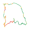
The map shows the published line. Provider ascent and descent retain their original meaning; estimates along the line are marked ≈. An additional return route is not automatically included in the line. Elevation profile estimated from Copernicus DEM. Provider statistics may differ.
Weather · next 48 hours
Loading weather …
BULLETIN
Avalanche bulletins along this route
No EUREGIO bulletin region is assigned to this line.
Check the official report for current danger and validity. Avalanche warning services
Regional avalanche bulletins do not assess an individual route. Check validity, elevation and aspect.
NATUR · NATURE
Protected areas along the route
Gadental
Naturschutzgebiet
Schneeaktivitäten
Schneeaktivitäten sind nur auf ausgewiesenen Flächen erlaubt.
Abfall entsorgen
Abfall entsorgen ist verboten.
Lagern und Biwakieren
Lagern und Biwakieren ist verboten.
Lärm (Tonbandgeräte, Abspielgeräte)
Lärm (Tonbandgeräte, Abspielgeräte) ist verboten.
Pflanzen sammeln
Pflanzen sammeln ist verboten.
Zelten
Zelten ist verboten.
Digitize the Planet · CC0 1.0 · Hinweise
Kartendarstellung vereinfacht; maßgeblich ist die verlinkte Originalquelle.
UNESCO-Biosphärenpark Großes Walsertal
Biosphärenpark
Kartendarstellung vereinfacht; maßgeblich ist die verlinkte Originalquelle.
Open on your iPhone · QR
Source & data
CC-BY-4.0: Österreich Werbung · CC BY 4.0
Österreich Werbung · 2026-08-31T15:41:44+02:00
Produced using Copernicus WorldDEM-30 © DLR e.V. 2010-2014 and © Airbus Defence and Space GmbH 2014-2018 provided under COPERNICUS by the European Union and ESA; all rights reserved.
Tour-ID: oew:datacycle_tour_61790314-1cbc-4e99-9a6c-f2d7c2ed4cca · Revision: 763f1842b77d