
← Back to the map

Hiking · Steiermark

Silberkarklamm - Guttenberghaus

Elevation profile

Explore the elevation profile
9641,5812,1980 km13.3 kmm
Distance
13.3 km
Ascent
1,330 m
Descent from source
1,330 m

Hike · Steiermark. The published line is 13.3 km long.
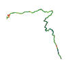
Route outline
Route outline without a basemap
Map layers

Take the route with you

Download GPX ↓

Original route geometry with estimated elevations from our terrain model. No account or app required.

CC BY 4.0 · Licence. Source credits are included in the file.

Highest point
≈ 2,198 m
Duration from source
6 h
Source difficulty—
Season from source
May, Jun, Jul, Aug, Sep
Start from sourceParkplatz Silberkarklamm, Ramsau, Österreich, 8972 Ramsau am Dachstein
Finish from sourceParkplatz Silberkarklamm, Ramsau, Österreich, 8972 Ramsau am Dachstein
Seasons from sourceAutumn · Spring · Summer
Website from sourceOpen website ↗
Distance from source13.3 km
Highest elevation from source2,200 m

The map shows the published line. Provider ascent and descent retain their original meaning; estimates along the line are marked ≈. An additional return route is not automatically included in the line. Elevation profile estimated from Copernicus DEM. Provider statistics may differ.

Weather · next 48 hours

Loading weather …

BULLETIN

Avalanche bulletins along this route

No EUREGIO bulletin region is assigned to this line.

Check the official report for current danger and validity. Avalanche warning services

Regional avalanche bulletins do not assess an individual route. Check validity, elevation and aspect.

NATUR · NATURE

Protected areas along the route

Dachstein-Salzkammergut

Landschaftsschutzgebiet

European Environment Agency (EEA) · CC BY 4.0

Kartendarstellung vereinfacht; maßgeblich ist die verlinkte Originalquelle.

Ein befestigter Holzsteg verläuft entlang steiler Felswände über einen Gebirgsbach. Im Hintergrund öffnet sich das Tal mit Blick auf bewaldete Hänge und alpine Gipfel.
Marlene Eggmayr · CC-BY · Original
Ein gesicherter Holzsteg verläuft entlang steiler Felswände. Im Hintergrund ist ein Gebirgsbach mit einem kleinen Wasserfall zu sehen.
Marlene Eggmayr · CC-BY · Original
Ein schmaler Pfad führt oberhalb des Silberkarsees durch alpines Gelände. Der See liegt eingebettet zwischen steilen Felswänden und grünen Hängen.
Marlene Eggmayr · CC-BY · Original
Eine Gruppe von Schafen rastet auf einer alpinen Weide zwischen der Silberkarklamm und dem Guttenberghaus. Im Hintergrund sind steile Felsen und Nebelschwaden zu sehen.
Marlene Eggmayr · CC-BY · Original
Das Guttenberghaus ist ein alpines Schutzhaus mit Holzfassade und Solarmodulen. Es liegt in felsigem Gelände unter grauem Himmel.
Marlene Eggmayr · CC-BY · Original
Die Aufnahme zeigt die karge Kalksteinlandschaft des Dachsteingebirges. Im Hintergrund ragt ein spitzer Felsgipfel über die umliegenden Geröllfelder hinaus.
Marlene Eggmayr · CC-BY · Original

IPHONE · ANDROID · WATCH

Maps and recording on your phone and watch.

Take your route offline. For iPhone, Android, Apple Watch and Wear OS.

Open in Hanglage ↗
Source & data

Data sources & safety

CC-BY-4.0: Österreich Werbung · CC BY 4.0

Österreich Werbung · 2026-07-23T15:15:35+02:00

Produced using Copernicus WorldDEM-30 © DLR e.V. 2010-2014 and © Airbus Defence and Space GmbH 2014-2018 provided under COPERNICUS by the European Union and ESA; all rights reserved.

Tour-ID: oew:contwise_tour_121371487 · Revision: 9328b965e830