
GeoSphere Austria · sources
Elevation profile
Snow depth
Model · 1 kmLoading snow model …
- Distance
- 8.0 km
- Ascent
- 940 m
- Descent from source
- 940 m
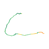
Ski tour · Kanton Wallis. The published line is 8.0 km long.
Map layers
Take the route with you
Download GPX ↓Original route geometry with estimated elevations from our terrain model. No account or app required.
ODbL 1.0 + CC BY-SA 3.0 FR · Licence. Source credits are included in the file.
- Highest point
- ≈ 3,126 m
Source directions
## Salita
Dalla Laemmerenhutte, portarsi sotto le falde rocciose del Laemmerenhorn, perdendo leggermente quota, fino a raggiungere lo Strubelgletscher. Aggirare la balza rocciosa, cominciando a salire verso nord, per circa 200 metri. Deviare quindi verso nord-est e percorrere senza problemi lo Steghorngletscher, raggiungendo l' ultimo pendio, che si affronta tenendosi nella sua parte meridionale, fino a sbucare in cresta. Seguire il largo spartiacque fino alla croce della vetta.
## Discesa
Per l'itinerario di salita.
Source safety information
* Gita breve, 700 metri circa, dormendo alla Laemmerenhutte.
* Dalla Laemmerenhutte, itinerario semplice, che non presenta difficoltà: pendii regolari conducono alla vetta. Tratto ripido al termine della Laemmerenboden, prima di raggiungere la Laemmerenhutte (50 metri circa).
* Sud/sud-ovest.
* Generalmente il ghiacciaio non presenta alcun problema.
Source directions
[img=165771 right]Steghorn depuis Gemmipass ou Lämmerenhütte[/img]
##Montée à la Lämmerenhütte # 1h15
Pour rejoindre la Lämmerenhütte, prendre le téléphérique du col de la Gemmi. Du haut du téléphérique, (tout plat pendant 55min, puis 20min de montée) direction W.
Le reck rocheux sous le refuge se franchit généralement par une diagonale de neige montant à gauche du refuge.
##Montée au Steghorn
À partir du refuge, rejoindre le bas du glacier du Wildstrubel en contournant les falaises issues du Lämmerenhorn (légère descente direction SW depuis le refuge). Rentrer doucement sur la langue du glacier en restant sur la droite, puis bifurquer monter par un vallon glaciaire venant buter sur les falaises du Grossstrubel.
Traverser le plateau longeant le Strubelegga puis rejoindre directement le sommet par les pentes WSW un peu plus raides.
##Descente
Par le même itinéraire.
Source safety information
* La montée est progressive.
* Cette rando se combine merveilleusement bien avec les transports publics.
The map shows the published line. Provider ascent and descent retain their original meaning; estimates along the line are marked ≈. An additional return route is not automatically included in the line. Elevation profile estimated from Copernicus DEM. Provider statistics may differ.
Weather · next 48 hours
Loading weather …
BULLETIN
Avalanche bulletins along this route
Bulletin regions along this line: Engstligen, Leukerbad - Lötschental
Regional avalanche bulletins do not assess an individual route. Check validity, elevation and aspect.
NATUR · NATURE
Protected areas along the route
Leukerbad
Bundesinventar der eidgenössischen Jagdbanngebiete
Kartendarstellung vereinfacht; maßgeblich ist die verlinkte Originalquelle.
Wildstrubelgletscher
Bundesinventar der Auengebiete von nationaler Bedeutung
Kartendarstellung vereinfacht; maßgeblich ist die verlinkte Originalquelle.
Open on your iPhone · QR
Source & data
Camptocamp · Camptocamp-Association, Marc Fournier, Céline Stern-Kiener, Christian, Compte Modération Topoguide, cath1e, rabot, botopo · https://www.camptocamp.org/routes/46247 · Coordinates reprojected; DEM elevation estimates · ODbL 1.0 + CC BY-SA 3.0 FR
Camptocamp · 2022-06-07T08:31:04.915229+00:00
Produced using Copernicus WorldDEM-30 © DLR e.V. 2010-2014 and © Airbus Defence and Space GmbH 2014-2018 provided under COPERNICUS by the European Union and ESA; all rights reserved.
Tour-ID: c2c:route/46247 · Revision: ea6230f190dc