
GeoSphere Austria · sources
Elevation profile
Snow depth
Model · 1 kmLoading snow model …
- Distance
- 4.8 km
- Ascent
- 950 m
- Descent from source
- 950 m
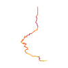
Ski tour · Aosta. The published line is 4.8 km long.
Map layers
Take the route with you
Download GPX ↓Original route geometry with estimated elevations from our terrain model. No account or app required.
ODbL 1.0 + CC BY-SA 3.0 FR · Licence. Source credits are included in the file.
- Highest point
- ≈ 2,600 m
Source directions
## Salita
Dal parcheggio di Rosiere (partenza della seggiovia) salire verso nord sotto il viadotto dell'autostrada portandosi gradualmente verso sx (scegliendo i tratti più innevati) fino a raggiungere il tracciato di una carrareccia che si segue per poche centinaia di metri deviando poi verso dx in direzione di alcune baite.
Circa 100 m più sopra si segue un tracciato di sentiero in piano verso dx che porta agli ampi pendii sommitali (quota 2000m circa); da qui senza percorso obbligato (su terreno a dossi) decisamente a N tenendosi preferibilmente sulla sx fino a raggiungere l'ampia e lunga dorsale che si segue fino in punta (piccolo rifugio chiuso).
## Discesa
lungo l'itinerario di salita o, con scarsità di neve, ci si porta appena a dx del colle Crevacol e da qui si raggiungono le piste battute fino alla partenza.
Source directions
[img=1278420 right]Plusieurs itinéraires possibles pour la large face SW[/img]
##Montée
Départ des Mottes/Rosière, au niveau du parking du télésiège (1663 m). Monter en passant sous le viaduc de la route, tirer progressivement direction NW jusqu'à atteindre une piste d'alpage menant à Limassey. Suivre cette piste et la quitter rapidement à l'amont en direction des alpage de Côtes 1932 m et Merdeux Dessus à 2004 m.
Suivre ensuite une piste plate à droite longeant le ru de Vullien qui mène à de vastes pentes sous le sommet. Monter direction N jusqu'à atteindre la large et longue crête sommitale, la suivre jusqu'au point culminant de la tête de Crévacol (petit refuge fermé).
##Descente
Par l'itinéraire de montée.
The map shows the published line. Provider ascent and descent retain their original meaning; estimates along the line are marked ≈. An additional return route is not automatically included in the line. Elevation profile estimated from Copernicus DEM. Provider statistics may differ.
Weather · next 48 hours
Loading weather …
BULLETIN
Avalanche bulletins along this route
No EUREGIO bulletin region is assigned to this line.
Check the official report for current danger and validity. Avalanche warning services
Regional avalanche bulletins do not assess an individual route. Check validity, elevation and aspect.
NATUR · NATURE
Protected areas along the route
No protected area was found along this line in the available dataset. Follow local notices.
Open on your iPhone · QR
Source & data
Camptocamp · Camptocamp-Association, Christian, Mathieu des Noes, cimaxi · https://www.camptocamp.org/routes/47458 · Coordinates reprojected; DEM elevation estimates · ODbL 1.0 + CC BY-SA 3.0 FR
Camptocamp · 2021-01-27T17:38:31.986843+00:00
Produced using Copernicus WorldDEM-30 © DLR e.V. 2010-2014 and © Airbus Defence and Space GmbH 2014-2018 provided under COPERNICUS by the European Union and ESA; all rights reserved.
Tour-ID: c2c:route/47458 · Revision: f4ca9ce4af10