
GeoSphere Austria · sources
Elevation profile
Snow depth
Model · 1 kmLoading snow model …
- Distance
- 4.4 km
- Ascent
- 750 m
- Descent from source
- 750 m
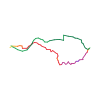
Ski tour · Kanton Freiburg. The published line is 4.4 km long.
Map layers
Take the route with you
Download GPX ↓Original route geometry with estimated elevations from our terrain model. No account or app required.
ODbL 1.0 + CC BY-SA 3.0 FR · Licence. Source credits are included in the file.
- Highest point
- ≈ 1,877 m
Source summary
Jolie course, près de Lausanne, sans plat, pour un petit dénivelé.
Source directions
[img=195180 right/]
## Montée
Depuis [[waypoints/203907|La Pudze]], partir par une petite route enneigée entre les deux chalets puis s'élever logiquement sur la gauche en suivant la combe déboisée.
Vers 1350 m, virer à droite de la pente principale jusqu'à un chalet qui se trouve au bord de la route (La Chaux, 1542 m). De là, par les pentes W, rejoindre la croupe SW et la suivre jusqu'à l'antécime (1850 m).
Suivre à pied l'arête facile mais exposée jusqu'au sommet (croix).
### Variante depuis Les Pueys
Du parking en bas du [[waypoints/306798|chalet des Pueys]], monter jusqu'à celui-ci et suivre sur la gauche le sentier en forêt (parcours raquettes) sur environ 300 m. Franchir un premier petit ruisseau. Peu après, avant d'en franchir un second, tirer sur la droite en longeant le cours d'eau pour atteindre une route. La suivre jusqu'au virage à droite et emprunter, quelques mètres après, une piste forestière sur la gauche puis remonter au mieux en longeant le ruisseau jusqu'à une route qui traverse horizontalement la forêt. De là, s'engager dans une forte pente parsemée de sapins et de souches pour ressortir sous l'alpage de La Chaux, où l'on rejoint l'itinéraire depuis La Pudze.
## Descente
Plusieurs options possibles : par un des couloirs qui partent de l'arête ou directement du sommet.
Source equipment information
* Crampons, piolet pour arriver au sommet par mauvaises conditions.
Source directions
*Irteera polita, Lausanne inguruan, plano gabe, eta desnible txiki baterako.*
**Nola iritxi :**
Les Paccots herria pasa eta gero Rathvel eruntz artu ezkerretara. Erradura baten ondoren (564005 153235) eskubitara hartu eta La Pudze-ko bi txaleten ondoan aparkatu (564455 153785).
**Igo :**
Bi txaleten tartean dagoen edurtutako bide batetan jarraitu eskerreruntz hartuta, erliebe logikoa jarraituz.
1350m inguruan, eskubitara hartu 1542m inguruan dagoen txaletera iritxi arte. Bertan S norabideko maldak hartu, aristara iritxi arte eta gero arista jarraitu gurtzerarte. Eskiak 1850m tara utzi daitezke.
**Jeitsiera :**
Bertan korredore dexente dauede, hauetariko bat hartu eta jeitsi. Gero bide berdina jarraitu autorarte.
The map shows the published line. Provider ascent and descent retain their original meaning; estimates along the line are marked ≈. An additional return route is not automatically included in the line. Elevation profile estimated from Copernicus DEM. Provider statistics may differ.
Weather · next 48 hours
Loading weather …
BULLETIN
Avalanche bulletins along this route
Bulletin regions along this line: Jaun, Gruyère
Regional avalanche bulletins do not assess an individual route. Check validity, elevation and aspect.
NATUR · NATURE
Protected areas along the route
Teysachaux
Bundesinventar der Trockenwiesen und -weiden von nationaler Bedeutung
Kartendarstellung vereinfacht; maßgeblich ist die verlinkte Originalquelle.
Open on your iPhone · QR
Source & data
Camptocamp · Camptocamp-Association, Céline Stern-Kiener, Christian, alexduchablais, Loïc Perrin, Thomas Ribière, Gorka Galdos, Fabien Quétier, Thomas Charbonneau, Rémi Chauvel, rabot · https://www.camptocamp.org/routes/45182 · Coordinates reprojected; DEM elevation estimates · ODbL 1.0 + CC BY-SA 3.0 FR
Camptocamp · 2018-03-27T23:43:30.477268+00:00
Produced using Copernicus WorldDEM-30 © DLR e.V. 2010-2014 and © Airbus Defence and Space GmbH 2014-2018 provided under COPERNICUS by the European Union and ESA; all rights reserved.
Tour-ID: c2c:route/45182 · Revision: 55e792400fe8