
GeoSphere Austria · sources
Ski tours · Kanton Bern
Walighürli · Von Feutersoey über die N-Flanke und den NE-Grat
Elevation profile
Snow depth
Model · 1 kmLoading snow model …
- Distance
- 8.6 km
- Ascent
- 890 m
- Descent from source
- 890 m
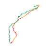
Ski tour · Kanton Bern. The published line is 8.6 km long.
Map layers
Take the route with you
Download GPX ↓Original route geometry with estimated elevations from our terrain model. No account or app required.
ODbL 1.0 + CC BY-SA 3.0 FR · Licence. Source credits are included in the file.
- Highest point
- ≈ 2,044 m
Source directions
[img=260509 right]Routen Walighürli[/img]
##Aufstieg
Von Feutersoey (1131m) Richtung SW gehen zur Wintermatte und Tuxberg (1367m). Den Wanderweg durch den Wald nach Schneeweid (1527m) folgen, und dann Richtung S zur N-Flanke gehen, und den NW-Grat zum Gipfel folgen.
##Abfahrt
Dieselbe Route oder durch den Waldlichtungen die Straße zum Arnensee erreichen und dann diese Richtung Feutersoey nehmen.
Source safety information
* Diese Route ist auch bei Lawinengefahr begehbar.
* Dieser Gipfel ist auch ein Helicopter-landeplatz.
Source directions
##Accès
A Feutersoey, prendre la route du lac d'Arnon (notée Arnensee!) sur 500 m. Stationner à l'entrée de la forêt, avant l'interdiction de circuler.
[img=260509 right]Itinéraires Wallighürli[/img]
##Montée
Du parking, monter sur l'épaule à travers champs et quelques clairières en direction SW. Gagner les chalets Wintermatte et Tuxberg (1367 m).
Suivre la route sur 200 m puis monter à travers prés en direction du premier chalet de Schneeweid (1527 m). Monter finalement au SSW en direction du sommet au travers des très larges clairières.
On rejoint généralement la crête NE juste sous le sommet que l'on rejoint par quelques mètres un peu plus raides.
##Descente
* Le plus évident est de descendre directement par l'itinéraire de montée. F/S2.
* Il est également possible de descendre versant E sur Vordere Walig puis de suivre la route qui nous ramène aux chalets de Tuxberg (1367 m) PD/S2. Cette variante est cependant peu intéressante vu que l'on fait finalement beaucoup de traverses.
* Finalement, certains descendront jusqu'au chalet de Schopfi (1502 m) puis rejoindront la route principale 1 km au N de Gsteig.
* Attention à ne pas descendre directement sur Gsteig, il y a de nombreux rochers.
Source safety information
!!!! L'itinéraire passe par ou à proximité d'une zone de tranquillité pour la faune; les itinéraires autorisés sont affichés sur le site [Respecter c'est protéger](http://www.respecter-cest-proteger.ch/index.php?id=411&L=1).
* Véritable promenade familiale, cette course est généralement très fréquentée, surtout lorsque les conditions nivologiques sont défavorables ailleurs !
* À noter que ce sommet fait également office de lieu de dépose pour l'héliski :-(
The map shows the published line. Provider ascent and descent retain their original meaning; estimates along the line are marked ≈. An additional return route is not automatically included in the line. Elevation profile estimated from Copernicus DEM. Provider statistics may differ.
Weather · next 48 hours
Loading weather …
BULLETIN
Avalanche bulletins along this route
Bulletin regions along this line: Gstaad
Regional avalanche bulletins do not assess an individual route. Check validity, elevation and aspect.
NATUR · NATURE
Protected areas along the route
No protected area was found along this line in the available dataset. Follow local notices.
Open on your iPhone · QR
Source & data
Camptocamp · Camptocamp-Association, Céline Stern-Kiener, Thomas Ribière, Stephane Peiti, Nicolas Cherix, Thomas Charbonneau, rabot, botopo, botop · https://www.camptocamp.org/routes/45437 · Coordinates reprojected; DEM elevation estimates · ODbL 1.0 + CC BY-SA 3.0 FR
Camptocamp · 2020-10-22T12:50:41.148090+00:00
Produced using Copernicus WorldDEM-30 © DLR e.V. 2010-2014 and © Airbus Defence and Space GmbH 2014-2018 provided under COPERNICUS by the European Union and ESA; all rights reserved.
Tour-ID: c2c:route/45437 · Revision: 84d8b3a45bd0