
GeoSphere Austria · sources
Elevation profile
Snow depth
Model · 1 kmLoading snow model …
- Distance
- 14.5 km
- Ascent
- 1,168 m
- Descent from source
- 1,170 m
Ski tour · Kanton Bern. The published line is 14.5 km long.
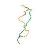
Map layers
Take the route with you
Download GPX ↓Original route geometry with estimated elevations from our terrain model. No account or app required.
ODbL 1.0 + CC BY-SA 3.0 FR · Licence. Source credits are included in the file.
- Highest point
- ≈ 1,830 m
Source summary
Balade préalpine très sûre mais exigeant de la neige à basse altitude
Source directions
De la gare de Ringholdigen, monter en rive gauche du torrent aux chalets de Feldmöser, puis emprunter la piste forestière à gauche jusqu'à Rinderalp d'où le sommet s'atteint facilement. À la descente sous Rinderalp, prendre plutôt le goulet forestier (S3) qui rejoint Feldmöser. Tirer à droite à plat pour descendre en rive droite en passant au voisinage de l'Ägelsee puis retraverser le torrent à pied par une route déneigée (Pont à la quote 788 m) avant de retrouver la trace de montée.
Source safety information
Sous les 1000 m, le bon itinéraire dépend de l'ouverture des clôtures...autres descentes possibles sur Erlenbach ou sur le Diemtigtal.
The map shows the published line. Provider ascent and descent retain their original meaning; estimates along the line are marked ≈. An additional return route is not automatically included in the line. Elevation profile estimated from Copernicus DEM. Provider statistics may differ.
Weather · next 48 hours
Loading weather …
BULLETIN
Avalanche bulletins along this route
Bulletin regions along this line: Niedersimmental, Obersimmental
Regional avalanche bulletins do not assess an individual route. Check validity, elevation and aspect.
NATUR · NATURE
Protected areas along the route
Feldmöser
Bundesinventar der Trockenwiesen und -weiden von nationaler Bedeutung
Kartendarstellung vereinfacht; maßgeblich ist die verlinkte Originalquelle.
Gelbergallmi
Bundesinventar der Flachmoore von nationaler Bedeutung
Kartendarstellung vereinfacht; maßgeblich ist die verlinkte Originalquelle.
Open on your iPhone · QR
Source & data
Camptocamp · BertrandSemelet, botopo · https://www.camptocamp.org/routes/1277105 · Coordinates reprojected; DEM elevation estimates · ODbL 1.0 + CC BY-SA 3.0 FR
Camptocamp · 2021-01-26T06:04:03.449088+00:00
Produced using Copernicus WorldDEM-30 © DLR e.V. 2010-2014 and © Airbus Defence and Space GmbH 2014-2018 provided under COPERNICUS by the European Union and ESA; all rights reserved.
Tour-ID: c2c:route/1277105 · Revision: 882c4a118233