Kondition
40 (Quellskala 0–100)
 HanglageSki touring & trail running
Loading snow model …
Ski tour · Bayern. The published line is 8.5 km long.
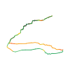
Original route geometry with estimated elevations from our terrain model. No account or app required.
CC0 1.0 · Licence. Source credits are included in the file.
Kurze und schöne Aussichtstour vom Spitzingsee aus. Die Firstalmen laden zur Einkehr ein und einzigartige Blicke auf den Schliersee und Spitzingsee warten am Gipfel. Durch die Vielbegangenheit dieser Tour häufig gut gespurt. Konditionell mittelschwer.
Durch die höhere Ausgangslage im Frühjahr zu empfehlen, erst recht durch die südliche Ausrichtung, was zu traumhaften Firnbedingungen führen kann.
Bitte beachtet, dass die Natur gerade in der kalten Jahreszeit besonders empfindlich ist. Haltet bitte die angegebenen Auf- und Abstiege ein, um nicht die Schutzgebiete der Flora und Fauna zu zerstören.
Gipfeltour mit Einkehrmöglichkeit, blendender Aussicht und alpinem Flair. Einer der Klassiker im bayerischen Oberland.
These notices come from the stored source snapshot. They do not establish a current closure. Check the source website for current information.
40 (Quellskala 0–100)
60 (Quellskala 0–100)
80 (Quellskala 0–100)
The map shows the published line. Provider ascent and descent retain their original meaning; estimates along the line are marked ≈. An additional return route is not automatically included in the line. Elevation profile estimated from Copernicus DEM. Provider statistics may differ.
Loading weather …
BULLETIN
Bulletin regions along this line: Bavarian Prealps Central
Check the official report for current danger and validity. Avalanche warning services
A Bavarian danger level is shown only with a valid bulletin. Lawinenwarndienst Bayern
Regional avalanche bulletins do not assess an individual route. Check validity, elevation and aspect.
NATUR · NATURE
Landschaftsschutzgebiet
Abfall entsorgen ist verboten.
Nutzung von Schwimmhilfe (Surfbretter, Luftmatratze) ist in ausgewiesenen Bereichen verboten. Es ist verboten, den Spitzingsee mit Segelsurfern zu befahren.
Wasserfahrzeuge (ohne Motor) sind in ausgewiesenen Bereichen verboten. Für Fahrzeuge ohne Eigenantrieb (einschließlich Schlauchboote, Luftmatratzen u. ä.) ist es verboten, sich dem westlichen Ufer oder den Ried- und Röhrichtzonen zu nähern, am westlichen Ufer anzulegen oder von dort Fahrzeuge einzubringen.
Zelten ist nur auf ausgewiesenen Plätzen erlaubt.
Digitize the Planet · CC0 1.0 · Hinweise
Bundesamt für Naturschutz · GeoNutzV
Verordnung zum Schutze des Spitzingsees und seiner Umgebung ·
Verordnung über die Regelung des Gemeingebrauchs auf dem Spitzingsee ·
Kartendarstellung vereinfacht; maßgeblich ist die verlinkte Originalquelle.
BayernCloud Tourismus · CC0 1.0 · CC0 1.0
BayernCloud Tourismus · 2026-09-30T22:07:24.972+02:00
Produced using Copernicus WorldDEM-30 © DLR e.V. 2010-2014 and © Airbus Defence and Space GmbH 2014-2018 provided under COPERNICUS by the European Union and ESA; all rights reserved.
Tour-ID: bct:2cca3513-f8f5-483a-9659-75faee13dcb4 · Revision: fb0de29b5e7f