
GeoSphere Austria · sources
Elevation profile
Snow depth
Model · 1 kmLoading snow model …
- Distance
- 7.8 km
- Ascent
- 1,010 m
- Descent from source
- 1,010 m
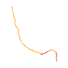
Ski tour · Savoie. The published line is 7.8 km long.
Map layers
Take the route with you
Download GPX ↓Original route geometry with estimated elevations from our terrain model. No account or app required.
ODbL 1.0 + CC BY-SA 3.0 FR · Licence. Source credits are included in the file.
- Highest point
- ≈ 2,671 m
Source summary
Longue randonnée (15 km AR) pour un dénivelé raisonnable (1000 m) dans ces superbes Cerces savoyardes.
Source directions
##Montée
Depuis le hameau de Bonnenuit 1670 m ou 70 m plus haut au parking des Réaux 1740 m, suivre la route du col du Galibier sur 3 km jusqu'au Plan Lachat 1960 m (1h). C'est la partie monotone de la randonnée mais c'est beau quand même!
De Plan Lachat suivre la piste des Rochilles jusqu'au Mottets 2130 m (0h30), puis deux lacets au-dessus prendre dans les alpages en pente modérée jusqu'au camp des Rochilles 2420 m (1h) sous la superbe paroi du pic de l'Aigle.
Au pied de la combe N, la remonter au plus évident des itinéraires qui même au collet de la Fourche en une petite heure à peine.
##Descente
Par le même itinéraire.
Source safety information
Rando assez "safe" par nivologie instable.
La combe N quoique courte est sympa à descendre en poudre.
Les versants S sous le camp des Rochilles rive droite sont rapidement transformées et c'est très plaisant à skier
Il y a souvent une très grosse corniche qui domine le versant S du collet (versant au-dessus du lac des Cerces).
The map shows the published line. Provider ascent and descent retain their original meaning; estimates along the line are marked ≈. An additional return route is not automatically included in the line. Elevation profile estimated from Copernicus DEM. Provider statistics may differ.
Weather · next 48 hours
Loading weather …
BULLETIN
Avalanche bulletins along this route
No EUREGIO bulletin region is assigned to this line.
Check the official report for current danger and validity. Avalanche warning services
Regional avalanche bulletins do not assess an individual route. Check validity, elevation and aspect.
NATUR · NATURE
Protected areas along the route
No protected area was found along this line in the available dataset. Follow local notices.
Open on your iPhone · QR
Source & data
Camptocamp · Christian, Patrick Prele, Borut, CaBot · https://www.camptocamp.org/routes/1395336 · Coordinates reprojected; DEM elevation estimates · ODbL 1.0 + CC BY-SA 3.0 FR
Camptocamp · 2022-02-23T09:53:34.680242+00:00
Produced using Copernicus WorldDEM-30 © DLR e.V. 2010-2014 and © Airbus Defence and Space GmbH 2014-2018 provided under COPERNICUS by the European Union and ESA; all rights reserved.
Tour-ID: c2c:route/1395336 · Revision: 673b59d13471