
GeoSphere Austria · sources
Elevation profile
Snow depth
Model · 1 kmLoading snow model …
- Distance
- 3.3 km
- Ascent
- 1,020 m
- Descent from source
- 1,020 m
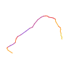
Ski tour · Kanton Wallis. The published line is 3.3 km long.
Map layers
Take the route with you
Download GPX ↓Original route geometry with estimated elevations from our terrain model. No account or app required.
ODbL 1.0 + CC BY-SA 3.0 FR · Licence. Source credits are included in the file.
- Highest point
- ≈ 2,686 m
Source directions
Depuis l’arrêt du Car Postal Fluh, prendre la route qui passe à Fluh et continuer jusqu'à Sengg. AU niveau des chalets, viser le coin NW de la clairière, puis prendre le chemin dans la forêt qui traverse vers une seconde clairière. remonter celle-ci puis prendre un thalweg dans la forêt de mélèzes droit au-dessus (ça suit plus ou moins le chemin pédestre).
On sort de la forêt en obliquant à gauche vers 2040 m. remonter ensuite le mur légèrement boisé à gauche jusqu'à 2260 m. selon l'enneigement, remonter droit au-dessus ou à gauche puis rejoindre le point 2495 m, de la remonter droit au-dessus vers un petit col puis rejoindre le sommet par la crête.
Source safety information
Itinéraire qui demande un bon enneigement car au-dessus de 2200 m, il y a des gros cailloux partout.
Neige stable requise car on remonte des pentes qui sont sous des couloirs ou pentes plus raides (senggflue) et certaines sections font 30-35°.
Jolie petite course à 2 pas de Sass Fee, mais loin des pylônes.
The map shows the published line. Provider ascent and descent retain their original meaning; estimates along the line are marked ≈. An additional return route is not automatically included in the line. Elevation profile estimated from Copernicus DEM. Provider statistics may differ.
Weather · next 48 hours
Loading weather …
BULLETIN
Avalanche bulletins along this route
Bulletin regions along this line: Saas Fee
Regional avalanche bulletins do not assess an individual route. Check validity, elevation and aspect.
NATUR · NATURE
Protected areas along the route
No protected area was found along this line in the available dataset. Follow local notices.
Open on your iPhone · QR
Source & data
Camptocamp · Julien Vallet, botopo · https://www.camptocamp.org/routes/1379205 · Coordinates reprojected; DEM elevation estimates · ODbL 1.0 + CC BY-SA 3.0 FR
Camptocamp · 2022-01-09T04:58:50.467318+00:00
Produced using Copernicus WorldDEM-30 © DLR e.V. 2010-2014 and © Airbus Defence and Space GmbH 2014-2018 provided under COPERNICUS by the European Union and ESA; all rights reserved.
Tour-ID: c2c:route/1379205 · Revision: bd24576bbb19