
GeoSphere Austria · sources
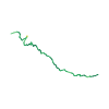
Elevation profile
Snow depth
Model · 1 kmLoading snow model …
- Distance
- 5.8 km
- Ascent
- 1,290 m
- Descent from source
- 1,290 m
Ski tour · Savoie. The published line is 5.8 km long.
Map layers
Take the route with you
Download GPX ↓Original route geometry with estimated elevations from our terrain model. No account or app required.
ODbL 1.0 + CC BY-SA 3.0 FR · Licence. Source credits are included in the file.
- Highest point
- ≈ 2,545 m
Source summary
Itinéraire relativement facile menant à un sommet avec une vue splendide.
Source directions
La route goudronnée menant au camping du Glaisy et au-delà jusqu'à la Grange à Marc est habituellement fermée à la circulation l'hiver. On part donc du village même.
##Montée
De Notre-Dame du Pré, atteindre le sommet du téléski(démonté en octobre 2025) par la piste de ski "la Combe" et prendre le sentier partant à gauche dans la forêt. Passage pas très intéressant dans la forêt, mais le chemin est assez large. On passe par la clairière de la Grange à Marc avant de repasser en forêt puis d'atteindre un grand alpage plat, que l'on traverse pour passer devant une grande bergerie: la Halle de fruit commun (point 1981 m). Suivre alors la route pastorale du mont Jovet pour passer un passage raide et avalancheux. On arrive dans un vallon menant au Col du Jovet. Le suivre, et bien avant le col, atteindre la crête NW que l'on suit jusqu'au sommet. On peut aussi passer par le col et la face W.
##Descente
Par le même itinéraire.
Variante : on peut éviter le passage en forêt par une route descendant sur le versant de la Plagne à partir de la bergerie, puis une bifurcation permet de revenir sur les pistes du téléski.
Source safety information
- La descente par la forêt n'est pas facile pour les skieurs moyens.
- Pas beaucoup (voire pas du tout) de soleil en hiver avant 13-14h, on l'apprécie au sommet.
- Possibilité de monter avec le téléski grâce au forfait remontée unique (2€ en 2016).
The map shows the published line. Provider ascent and descent retain their original meaning; estimates along the line are marked ≈. An additional return route is not automatically included in the line. Elevation profile estimated from Copernicus DEM. Provider statistics may differ.
Weather · next 48 hours
Loading weather …
BULLETIN
Avalanche bulletins along this route
No EUREGIO bulletin region is assigned to this line.
Check the official report for current danger and validity. Avalanche warning services
Regional avalanche bulletins do not assess an individual route. Check validity, elevation and aspect.
NATUR · NATURE
Protected areas along the route
No protected area was found along this line in the available dataset. Follow local notices.
Open on your iPhone · QR
Source & data
Camptocamp · Camptocamp-Association, Nick l'Ermite, Mathieu des Noes, Patrice Davoine, Fabien Quétier, rabot, botopo, CaBot, botop · https://www.camptocamp.org/routes/45723 · Coordinates reprojected; DEM elevation estimates · ODbL 1.0 + CC BY-SA 3.0 FR
Camptocamp · 2026-04-11T07:05:26.589680+00:00
Produced using Copernicus WorldDEM-30 © DLR e.V. 2010-2014 and © Airbus Defence and Space GmbH 2014-2018 provided under COPERNICUS by the European Union and ESA; all rights reserved.
Tour-ID: c2c:route/45723 · Revision: 88e81cd034f2