
GeoSphere Austria · sources
Elevation profile
Snow depth
Model · 1 kmLoading snow model …
- Distance
- 3.4 km
- Ascent
- 1,270 m
- Descent from source
- 1,270 m
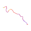
Ski tour · Sondrio. The published line is 3.4 km long.
Map layers
Take the route with you
Download GPX ↓Original route geometry with estimated elevations from our terrain model. No account or app required.
ODbL 1.0 + CC BY-SA 3.0 FR · Licence. Source credits are included in the file.
- Highest point
- ≈ 2,631 m
Source directions
Da Ponte Frera 1373m attraversato il ponticello si giunge presso un'area di sosta attrezzata; rintracciare il sentiero con segnavia n°10 che sale ripido e non sempre evidente nella vegetazione, sulla destra orografica della Val di Soffia. A circa 1650 m spostarsi gradualmente verso NE e passando in un tratto abbastanza esposto sotto un salto di roccia, raggiungere la Malga Nembra 1807 m. Ora su terreno più aperto continuare in direzione S portandosi alla base dell’evidente canale che si sale fino in cresta, quindi a sinistra su terreno facile fino alla cima.
Il canale, 450 metri di dislivello, presenta nella prima parte una pendenza costante di 35°/40°, mentre gli ultimi 150 metri di dislivello la pendenza è attorno ai 45°.
Source equipment information
Ramponi e piccozza
The map shows the published line. Provider ascent and descent retain their original meaning; estimates along the line are marked ≈. An additional return route is not automatically included in the line. Elevation profile estimated from Copernicus DEM. Provider statistics may differ.
Weather · next 48 hours
Loading weather …
BULLETIN
Avalanche bulletins along this route
No EUREGIO bulletin region is assigned to this line.
Check the official report for current danger and validity. Avalanche warning services
Regional avalanche bulletins do not assess an individual route. Check validity, elevation and aspect.
NATUR · NATURE
Protected areas along the route
No protected area was found along this line in the available dataset. Follow local notices.
Open on your iPhone · QR
Source & data
Camptocamp · berus, botopo · https://www.camptocamp.org/routes/868750 · Coordinates reprojected; DEM elevation estimates · ODbL 1.0 + CC BY-SA 3.0 FR
Camptocamp · 2018-07-29T12:19:52.479427+00:00
Produced using Copernicus WorldDEM-30 © DLR e.V. 2010-2014 and © Airbus Defence and Space GmbH 2014-2018 provided under COPERNICUS by the European Union and ESA; all rights reserved.
Tour-ID: c2c:route/868750 · Revision: feb345799094