
GeoSphere Austria · sources
Elevation profile
Snow depth
Model · 1 kmLoading snow model …
- Distance
- 6.7 km
- Ascent
- 850 m
- Descent from source
- 850 m
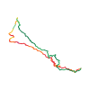
Ski tour · Sondrio. The published line is 6.7 km long.
Map layers
Take the route with you
Download GPX ↓Original route geometry with estimated elevations from our terrain model. No account or app required.
ODbL 1.0 + CC BY-SA 3.0 FR · Licence. Source credits are included in the file.
- Highest point
- ≈ 2,714 m
Source directions
Da **Arnoga** 1850 m circa, salire i prati in direzione NW seguendo il tracciato del vecchio skilift (ora la struttura è stata smantellata). Tenere le baite alla vostra sinistra e raggiungere la sommità dei prati, all'inizio del bosco. Addentrarsi al suo interno piegando a destra e risalendo una valletta che in breve porta alla sommità del tratto boscoso. (Attenzione in questo tratto in caso di abbondanti nevicate). Ora, senza percorso obbligato, salire gli ampi pendii (in direzione WNW) in direzione della poco evidente vetta del **Monte Sattaron 2716 m**. Se le condizioni danno adito a dubbi, meglio attenersi all'ampio dossone proveniente dalla vetta. Raggiunto il **Monte Sattaron**, seguire la cresta sommitale verso N, portandosi in pochi minuti sulla vetta della **Motta Grande 2702 m**, sci ai piedi.
Discesa: lungo l'itineario di risalita, divertendosi sui numerosi pendii e vallette che occupano l'ampio vallone.
Source safety information
Itinerario generalmente sicuro, con tratto ripido nel bosco. Attenzione ad evitare eventuali cornici che si creano frequentemente sotto la cima.
Dislivello contenuto ma buon sviluppo.
The map shows the published line. Provider ascent and descent retain their original meaning; estimates along the line are marked ≈. An additional return route is not automatically included in the line. Elevation profile estimated from Copernicus DEM. Provider statistics may differ.
Weather · next 48 hours
Loading weather …
BULLETIN
Avalanche bulletins along this route
No EUREGIO bulletin region is assigned to this line.
Check the official report for current danger and validity. Avalanche warning services
Regional avalanche bulletins do not assess an individual route. Check validity, elevation and aspect.
NATUR · NATURE
Protected areas along the route
No protected area was found along this line in the available dataset. Follow local notices.
Open on your iPhone · QR
Source & data
Camptocamp · José Picheral, Gianluca Moroni, cimaxi, Matteo (Alta Valtellina), rabot, botopo · https://www.camptocamp.org/routes/195961 · Coordinates reprojected; DEM elevation estimates · ODbL 1.0 + CC BY-SA 3.0 FR
Camptocamp · 2018-07-29T12:36:13.820736+00:00
Produced using Copernicus WorldDEM-30 © DLR e.V. 2010-2014 and © Airbus Defence and Space GmbH 2014-2018 provided under COPERNICUS by the European Union and ESA; all rights reserved.
Tour-ID: c2c:route/195961 · Revision: a2c08d03401c