
GeoSphere Austria · sources
Elevation profile
Snow depth
Model · 1 kmLoading snow model …
- Distance
- 9.9 km
- Ascent
- 900 m
- Descent from source
- 900 m
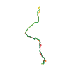
Ski tour · Kanton Graubünden. The published line is 9.9 km long.
Map layers
Take the route with you
Download GPX ↓Original route geometry with estimated elevations from our terrain model. No account or app required.
ODbL 1.0 + CC BY-SA 3.0 FR · Licence. Source credits are included in the file.
- Highest point
- ≈ 2,627 m
Source summary
Achtung: die Route 709 der Ski-Karte und des SAC-Führers ist falsch, da eine neue Wildschutz-Zone ausgeschieden wurde. Die neue Route ist:
Source directions
##Aufstieg
Von La Punt-Chamues-ch entlang dem Kinderlift dann dem Wanderweg folgen bis zum Punkt 1878 m (direkt hinter einem gut sichtbaren Holzhag). Nach links (Süd-Osten) wenden und dem in der Karte 1237 (Albulapass) gut sichtbaren Wanderweg folgen; in der Lichtung nach Osten wenden und zur Alp Müsella aufsteigen; von da zum Plateau Chaunt Sech, weiter Richtung Süd-Osten und schliesslich von Osten zum Gipfel.
##Abfahrt
Wie Aufstiegsroute.
Source safety information
!!!! Die Route führt durch (oder in der nähe) eine Wildruhezone; Die erlaubten Routen sind auf der Website [Respektiere deine Grenzen](http://www.respectiere-deine-grenzen.ch/) sichtbar.
Source directions
### Salita
dalla stazione di partenza della sciovia, risalire le piste fino al loro termine. Superati poi pochi metri di bosco si giunge ad una stradina. Seguirla verso destra (direzione SW), fino alla **quota 1878 m**. Deviare ora in direzione ESE e, sempre nei pressi del sentiero estivo, uscire dal bosco a raggiungere le baite dell'**Alp Müsella 2186 m**. Dall'alpeggio, superare in direzione S un breve ma ripido pendio (attenzione !) adducente ai più dolci pendii di **Chaunt Sech** . Sempre nella medesima direzione si giunge al piede dei ripidi pendii settentrionali del Munt Müsella ad una quota di circa 2450 m. Superarli direttamente (prudenza !) sbucando sull'amplissima sommità del **Munt** **Müsella**.
### Discesa
per il medesimo itinerario.
Source safety information
!!!! L'itinerario passa in prossimità di una zona di tranquillità per la fauna, gli itinerari autorizzati sono pubblicati nel sito [Chi rispetta protegge](http://www.chi-rispetta-protegge.ch).
Source summary
Attention : la description de l'itinéraire est fausse sur la carte 258 S Bergün et dans le livre du club alpin. L'itinéraire indiqué traverse une zone de forêt protégée. Le nouveau itinéraire est le suivant:
Source directions
##Montée
Atteindre le sommet du petit téléski et ensuite suivre le chemin forestier sur environ 800 m jusqu'au passage d'une clôture en bois (point 1878 m); prendre à gauche (direction SE) le chemin qui monte en direction de l'Alp Müsella (chemin bien visible sur la carte 1237 Albulapass).
Attention : en arrivant à la première clairière poursuivre vers l'E avant de tourner de nouveau vers le SE pour atteindre l'Alp Müsella.
Depuis là, monter sur le plateau Chaunt Sech et ensuite poursuivre en direction SE pour monter au sommet depuis l'E.
##Descente
Par le même itinéraire.
Source safety information
!!!! L'itinéraire passe par ou à proximité d'une zone de tranquillité pour la faune. Les itinéraires autorisés sont affichés sur le site [Respecter c'est protéger](http://www.respecter-cest-proteger.ch/index.php).
* Petit téléski au départ de la course.
* Très facile à ski (montée et descente), en snowboard la descente dans la forêt est un peu délicate, la montée en raquette est assez facile.
The map shows the published line. Provider ascent and descent retain their original meaning; estimates along the line are marked ≈. An additional return route is not automatically included in the line. Elevation profile estimated from Copernicus DEM. Provider statistics may differ.
Weather · next 48 hours
Loading weather …
BULLETIN
Avalanche bulletins along this route
Bulletin regions along this line: Zuoz, St. Moritz
Regional avalanche bulletins do not assess an individual route. Check validity, elevation and aspect.
NATUR · NATURE
Protected areas along the route
God Chamaduoir, God Fainchs
Wildruhezone
Schutzzeit: 20.12. - 30.04.
Betreten des Gebietes
Betreten des Gebietes ist nur auf ausgewiesenen Wegen vom 20. Dezember bis zum 30. April erlaubt.
Digitize the Planet · CC0 1.0 · Hinweise
Amt für Landwirtschaft und Geoinformation - Graubünden · opendata.swiss BY
Kartendarstellung vereinfacht; maßgeblich ist die verlinkte Originalquelle.
Open on your iPhone · QR
Source & data
Camptocamp · Camptocamp-Association, Céline Stern-Kiener, Franco Pecchio, oli'nem, rabot, botopo, botop · https://www.camptocamp.org/routes/45600 · Coordinates reprojected; DEM elevation estimates · ODbL 1.0 + CC BY-SA 3.0 FR
Camptocamp · 2025-03-18T18:44:39.865240+00:00
Produced using Copernicus WorldDEM-30 © DLR e.V. 2010-2014 and © Airbus Defence and Space GmbH 2014-2018 provided under COPERNICUS by the European Union and ESA; all rights reserved.
Tour-ID: c2c:route/45600 · Revision: da03829d5708