
GeoSphere Austria · sources
Elevation profile
Snow depth
Model · 1 kmLoading snow model …
- Distance
- 10.9 km
- Ascent
- 1,060 m
- Descent from source
- 1,060 m
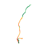
Ski tour · Trentino. The published line is 10.9 km long.
Map layers
Take the route with you
Download GPX ↓Original route geometry with estimated elevations from our terrain model. No account or app required.
ODbL 1.0 + CC BY-SA 3.0 FR · Licence. Source credits are included in the file.
- Highest point
- ≈ 3,283 m
Source directions
## Salita
Salita al Passo Presena con gli impianti del Tonale (dal Passo o da Ponte di Legno)
Discesa al Rifugio Mandrone, si mettono le pelli e si sale verso il ghiacciao sul lato destro (di solito evidenti tracce per gli innumerevoli passaggi delle gare e di chi fa il giro - in giornata - del Pisgana). Sul ghiacciaio, portarsi sul lato opposto, verso sinistra, oltrepassare la valletta che sale al Rifugio Caduti dell'Adamello, salire il ripido pendio verso est che porta a sinistra alla Croce di Giovanni Paolo II, a destra al Cannone. Al picco del Cannone (c'è veramente, è puntato verso il Trentino) si arriva sci ai piedi.
## Discesa
- per l'itinerario di salita
- Si scende dal pendio est e, per arrivare al Rifugio Caduti dell'Adamello, si taglia verso nord, a destra, poco sotto lo sperone roccioso della lunga Cresta della Croce. Si rimettono le pelli per gli ultimi 100 di dislivello in salita fino a Rifugio Caduti dell'Adamello.
*Giro che può essere percorso anche in senso inverso: salita alla Lobbia lambendo il Rifugio Caduti dell'Adamello, scollinare e raggiungere le cime.*
The map shows the published line. Provider ascent and descent retain their original meaning; estimates along the line are marked ≈. An additional return route is not automatically included in the line. Elevation profile estimated from Copernicus DEM. Provider statistics may differ.
Weather · next 48 hours
Loading weather …
BULLETIN
Avalanche bulletins along this route
Bulletin regions along this line: Adamello - Presanella, Sole, Pejo and Rabbi
Check the official report for current danger and validity. Avalanche warning services
Regional avalanche bulletins do not assess an individual route. Check validity, elevation and aspect.
NATUR · NATURE
Protected areas along the route
Parco naturale provinciale dell'Adamello Brenta
Parco naturale regionale/provinciale
Kartendarstellung vereinfacht; maßgeblich ist die verlinkte Originalquelle.
Open on your iPhone · QR
Source & data
Camptocamp · Giorgio Galvani, cimaxi, Antoine Marnat, rabot · https://www.camptocamp.org/routes/422621 · Coordinates reprojected; DEM elevation estimates · ODbL 1.0 + CC BY-SA 3.0 FR
Camptocamp · 2017-11-02T23:30:30.792397+00:00
Produced using Copernicus WorldDEM-30 © DLR e.V. 2010-2014 and © Airbus Defence and Space GmbH 2014-2018 provided under COPERNICUS by the European Union and ESA; all rights reserved.
Tour-ID: c2c:route/422621 · Revision: dae8d0ff6cc5