
GeoSphere Austria · sources
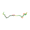
Elevation profile
Snow depth
Model · 1 kmLoading snow model …
- Distance
- 15.3 km
- Ascent
- 1,460 m
- Descent from source
- 1,460 m
Ski tour · Sondrio. The published line is 15.3 km long.
Map layers
Take the route with you
Download GPX ↓Original route geometry with estimated elevations from our terrain model. No account or app required.
ODbL 1.0 + CC BY-SA 3.0 FR · Licence. Source credits are included in the file.
- Highest point
- ≈ 2,372 m
Source directions
Poco oltre il parcheggio si stacca sulla destra la stradina che porta a RAVIZZE m 1282 e a CASE DI SOPRA, seguirla per alcuni km ed al suo termine entrare (verso destra) in VALLE DI PAI. Raggiugere il torrente lungo il sentiero pianeggiante e risalire alle baite di quota 1597 dopo averlo attraversato. Di seguito, passando per la baita di quota 1726 si raggiunge, dopo un breve ripido canalino, la baita a quota 1906. Ora la bella valletta soprastante porta in vista del MONTE ROTONDO. Compiere un'ampia curva verso destra in direzione di un grosso ometto di pietra posto su uno spallone. Dall' ometto si entra nella conca sotto il MONTE STAVELLO e,senza perdere quota, si raggiunge il colletto tra la cima sciistica (2390m) a sinistra e la vera cima (2416m) a destra. Proseguire sulla cresta sud-ovest con gli sci fin dove possibile, poi a piedi per gli ultimi 30m (piccozza e ramponi molto utili).
Source safety information
La sciata dall'anticima a sinistra del colle e' una validissima alternativa alla cresta alpinistica.
Source equipment information
Piccozza e ramponi per la cresta.
The map shows the published line. Provider ascent and descent retain their original meaning; estimates along the line are marked ≈. An additional return route is not automatically included in the line. Elevation profile estimated from Copernicus DEM. Provider statistics may differ.
Weather · next 48 hours
Loading weather …
BULLETIN
Avalanche bulletins along this route
No EUREGIO bulletin region is assigned to this line.
Check the official report for current danger and validity. Avalanche warning services
Regional avalanche bulletins do not assess an individual route. Check validity, elevation and aspect.
NATUR · NATURE
Protected areas along the route
No protected area was found along this line in the available dataset. Follow local notices.
Open on your iPhone · QR
Source & data
Camptocamp · Paolo Recalcati, Giovanni Rovedatti, rabot, botopo · https://www.camptocamp.org/routes/204514 · Coordinates reprojected; DEM elevation estimates · ODbL 1.0 + CC BY-SA 3.0 FR
Camptocamp · 2018-11-26T15:58:05.441526+00:00
Produced using Copernicus WorldDEM-30 © DLR e.V. 2010-2014 and © Airbus Defence and Space GmbH 2014-2018 provided under COPERNICUS by the European Union and ESA; all rights reserved.
Tour-ID: c2c:route/204514 · Revision: 1f677dc3c445